
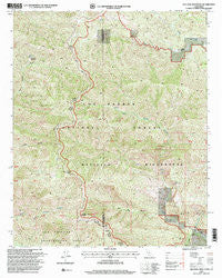
~ Old Man Mountain CA topo map, 1:24000 scale, 7.5 X 7.5 Minute, Historical, 1995, updated 2000
Old Man Mountain, California, USGS topographic map dated 1995.
Includes geographic coordinates (latitude and longitude). This topographic map is suitable for hiking, camping, and exploring, or framing it as a wall map.
Printed on-demand using high resolution imagery, on heavy weight and acid free paper, or alternatively on a variety of synthetic materials.
Topos available on paper, Waterproof, Poly, or Tyvek. Usually shipping rolled, unless combined with other folded maps in one order.
- Product Number: USGS-5519883
- Free digital map download (high-resolution, GeoPDF): Old Man Mountain, California (file size: 19 MB)
- Map Size: please refer to the dimensions of the GeoPDF map above
- Weight (paper map): ca. 55 grams
- Map Type: POD USGS Topographic Map
- Map Series: HTMC
- Map Verison: Historical
- Cell ID: 33094
- Scan ID: 102330
- Imprint Year: 2000
- Woodland Tint: Yes
- Aerial Photo Year: 1994
- Edit Year: 1995
- Datum: NAD27
- Map Projection: Lambert Conformal Conic
- Map published by United States Forest Service
- Map Language: English
- Scanner Resolution: 600 dpi
- Map Cell Name: Old Man Mountain
- Grid size: 7.5 X 7.5 Minute
- Date on map: 1995
- Map Scale: 1:24000
- Geographical region: California, United States
Neighboring Maps:
All neighboring USGS topo maps are available for sale online at a variety of scales.
Spatial coverage:
Topo map Old Man Mountain, California, covers the geographical area associated the following places:
- La Carpa Potreros - La Carpa Spring - Matilija Rustic Campsite - Matilija Rustic Campsite - West Fork Matilija Creek - Upper North Fork Matilija Creek - Willow Creek - Matilija Campsite - Abadi Creek - Upper Hartman Ranch - Old Man Canyon - Old Man Mountain - Monte Arido - Matilija Wilderness - Murietta Canyon - Three Sisters
- Map Area ID: AREA34.62534.5-119.5-119.375
- Northwest corner Lat/Long code: USGSNW34.625-119.5
- Northeast corner Lat/Long code: USGSNE34.625-119.375
- Southwest corner Lat/Long code: USGSSW34.5-119.5
- Southeast corner Lat/Long code: USGSSE34.5-119.375
- Northern map edge Latitude: 34.625
- Southern map edge Latitude: 34.5
- Western map edge Longitude: -119.5
- Eastern map edge Longitude: -119.375


