
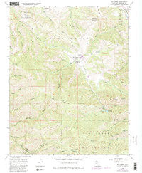
~ Mt Carmel CA topo map, 1:24000 scale, 7.5 X 7.5 Minute, Historical, 1956, updated 1988
Mt Carmel, California, USGS topographic map dated 1956.
Includes geographic coordinates (latitude and longitude). This topographic map is suitable for hiking, camping, and exploring, or framing it as a wall map.
Printed on-demand using high resolution imagery, on heavy weight and acid free paper, or alternatively on a variety of synthetic materials.
Topos available on paper, Waterproof, Poly, or Tyvek. Usually shipping rolled, unless combined with other folded maps in one order.
- Product Number: USGS-5519123
- Free digital map download (high-resolution, GeoPDF): Mt Carmel, California (file size: 15 MB)
- Map Size: please refer to the dimensions of the GeoPDF map above
- Weight (paper map): ca. 55 grams
- Map Type: POD USGS Topographic Map
- Map Series: HTMC
- Map Verison: Historical
- Cell ID: 30516
- Scan ID: 293274
- Imprint Year: 1988
- Woodland Tint: Yes
- Photo Revision Year: 1983
- Aerial Photo Year: 1980
- Edit Year: 1983
- Field Check Year: 1956
- Datum: NAD27
- Map Projection: Polyconic
- Map published by United States Geological Survey
- Map Language: English
- Scanner Resolution: 600 dpi
- Map Cell Name: Mount Carmel
- Grid size: 7.5 X 7.5 Minute
- Date on map: 1956
- Map Scale: 1:24000
- Geographical region: California, United States
Neighboring Maps:
All neighboring USGS topo maps are available for sale online at a variety of scales.
Spatial coverage:
Topo map Mt Carmel, California, covers the geographical area associated the following places:
- Pine Creek Camp - Black Rock Ridge - Pinyon Peak - Las Gazas Creek - Van Winkleys Canyon - White Rock Gun Club - San Carlos Ranch - Mid - Coast Fire Brigade - Palo Corona - Vasquez Knob - Apple Tree Rustic Campsite - Long Ridge - San Clemente Ridge - Black Rock Creek 643 Dam - Salsipuedes Creek - Williams Canyon - Chamisal Ridge - Sid Ormsbee Lookout - San Francisquito Flat - Fish Head Hill - Devils Peak - San Francisquito - White Rock Ridge - White Rock Lake - Twin Peaks - Turner Creek Camp - Long Ridge - Mount Carmel
- Map Area ID: AREA36.536.375-121.875-121.75
- Northwest corner Lat/Long code: USGSNW36.5-121.875
- Northeast corner Lat/Long code: USGSNE36.5-121.75
- Southwest corner Lat/Long code: USGSSW36.375-121.875
- Southeast corner Lat/Long code: USGSSE36.375-121.75
- Northern map edge Latitude: 36.5
- Southern map edge Latitude: 36.375
- Western map edge Longitude: -121.875
- Eastern map edge Longitude: -121.75


