
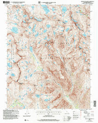
~ Mount Goddard CA topo map, 1:24000 scale, 7.5 X 7.5 Minute, Historical, 2004, updated 2007
Mount Goddard, California, USGS topographic map dated 2004.
Includes geographic coordinates (latitude and longitude). This topographic map is suitable for hiking, camping, and exploring, or framing it as a wall map.
Printed on-demand using high resolution imagery, on heavy weight and acid free paper, or alternatively on a variety of synthetic materials.
Topos available on paper, Waterproof, Poly, or Tyvek. Usually shipping rolled, unless combined with other folded maps in one order.
- Product Number: USGS-5518941
- Free digital map download (high-resolution, GeoPDF): Mount Goddard, California (file size: 19 MB)
- Map Size: please refer to the dimensions of the GeoPDF map above
- Weight (paper map): ca. 55 grams
- Map Type: POD USGS Topographic Map
- Map Series: HTMC
- Map Verison: Historical
- Cell ID: 30597
- Scan ID: 101650
- Imprint Year: 2007
- Woodland Tint: Yes
- Aerial Photo Year: 1998
- Edit Year: 2004
- Datum: NAD83
- Map Projection: Universal Transverse Mercator
- Map published by United States Forest Service
- Map Language: English
- Scanner Resolution: 600 dpi
- Map Cell Name: Mount Goddard
- Grid size: 7.5 X 7.5 Minute
- Date on map: 2004
- Map Scale: 1:24000
- Geographical region: California, United States
Neighboring Maps:
All neighboring USGS topo maps are available for sale online at a variety of scales.
Spatial coverage:
Topo map Mount Goddard, California, covers the geographical area associated the following places:
- Disappearing Creek - Muir Pass - Tunemah Lake - Cathedral Lake - Mount Reinstein - Wheel Mountain - Mount Solomons - Ionian Basin - Battalion Lake - The Three Sirens - Finger Peak - Eve Lake - Lake McDermand - Wanda Lake - Enchanted Gorge - Mount McDuffie - Black Giant - Mount Goddard - Helen Lake - White Divide - Martha Lake - Ragged Spur - Goddard Divide - Mount Hansen (not official) - Scylla - Valor Lake - Pearl Lake - Chapel Lake - Black Divide - Charybdis - Blue Canyon Peak - Regiment Lake
- Map Area ID: AREA37.12537-118.75-118.625
- Northwest corner Lat/Long code: USGSNW37.125-118.75
- Northeast corner Lat/Long code: USGSNE37.125-118.625
- Southwest corner Lat/Long code: USGSSW37-118.75
- Southeast corner Lat/Long code: USGSSE37-118.625
- Northern map edge Latitude: 37.125
- Southern map edge Latitude: 37
- Western map edge Longitude: -118.75
- Eastern map edge Longitude: -118.625


