
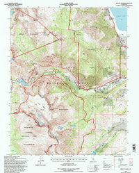
~ Mount Dana CA topo map, 1:24000 scale, 7.5 X 7.5 Minute, Historical, 1994, updated 1997
Mount Dana, California, USGS topographic map dated 1994.
Includes geographic coordinates (latitude and longitude). This topographic map is suitable for hiking, camping, and exploring, or framing it as a wall map.
Printed on-demand using high resolution imagery, on heavy weight and acid free paper, or alternatively on a variety of synthetic materials.
Topos available on paper, Waterproof, Poly, or Tyvek. Usually shipping rolled, unless combined with other folded maps in one order.
- Product Number: USGS-5518911
- Free digital map download (high-resolution, GeoPDF): Mount Dana, California (file size: 17 MB)
- Map Size: please refer to the dimensions of the GeoPDF map above
- Weight (paper map): ca. 55 grams
- Map Type: POD USGS Topographic Map
- Map Series: HTMC
- Map Verison: Historical
- Cell ID: 30549
- Scan ID: 101644
- Imprint Year: 1997
- Woodland Tint: Yes
- Aerial Photo Year: 1993
- Field Check Year: 1994
- Datum: NAD27
- Map Projection: Lambert Conformal Conic
- Map published by United States Forest Service
- Map Language: English
- Scanner Resolution: 600 dpi
- Map Cell Name: Mount Dana
- Grid size: 7.5 X 7.5 Minute
- Date on map: 1994
- Map Scale: 1:24000
- Geographical region: California, United States
Neighboring Maps:
All neighboring USGS topo maps are available for sale online at a variety of scales.
Spatial coverage:
Topo map Mount Dana, California, covers the geographical area associated the following places:
- Gibbs Lake Trailhead - Walker Lake 6-035 Dam - Warren Fork Campground - Mono Lake Post Office (historical) - Rhinedollar 104-041 Dam - Mount Dana - Aspen Campground - Big Bend Campground - Gibbs Lake - Log Cabin Wilderness Boy Scout Camp - Bloody Canyon - Dana Lake - Ellery Lake - Mount Gibbs - Moraine Campground - Warren Fork - Tioga Junction Campground - Upper Horse Meadow - Lower Horse Meadow - Warren Fork Trailhead - Lee Vining Peak - Ellery Lake Campground - Beartrack Canyon - Log Cabin Mine - Ellery Campground - Dana Plateau - Gibbs Canyon - Junction Campground - Boulder Campground - Tioga Peak - Mono Dome - Mount Warren - Lee Vining Ranger Station - Kidney Lake - Mine Creek - Tioga Pass Resort
- Map Area ID: AREA3837.875-119.25-119.125
- Northwest corner Lat/Long code: USGSNW38-119.25
- Northeast corner Lat/Long code: USGSNE38-119.125
- Southwest corner Lat/Long code: USGSSW37.875-119.25
- Southeast corner Lat/Long code: USGSSE37.875-119.125
- Northern map edge Latitude: 38
- Southern map edge Latitude: 37.875
- Western map edge Longitude: -119.25
- Eastern map edge Longitude: -119.125


