
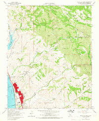
~ Morro Bay North CA topo map, 1:24000 scale, 7.5 X 7.5 Minute, Historical, 1965, updated 1968
Morro Bay North, California, USGS topographic map dated 1965.
Includes geographic coordinates (latitude and longitude). This topographic map is suitable for hiking, camping, and exploring, or framing it as a wall map.
Printed on-demand using high resolution imagery, on heavy weight and acid free paper, or alternatively on a variety of synthetic materials.
Topos available on paper, Waterproof, Poly, or Tyvek. Usually shipping rolled, unless combined with other folded maps in one order.
- Product Number: USGS-5518857
- Free digital map download (high-resolution, GeoPDF): Morro Bay North, California (file size: 13 MB)
- Map Size: please refer to the dimensions of the GeoPDF map above
- Weight (paper map): ca. 55 grams
- Map Type: POD USGS Topographic Map
- Map Series: HTMC
- Map Verison: Historical
- Cell ID: 30314
- Scan ID: 293140
- Imprint Year: 1968
- Woodland Tint: Yes
- Aerial Photo Year: 1963
- Field Check Year: 1965
- Datum: NAD27
- Map Projection: Polyconic
- Map published by United States Geological Survey
- Map Language: English
- Scanner Resolution: 600 dpi
- Map Cell Name: Morro Bay North
- Grid size: 7.5 X 7.5 Minute
- Date on map: 1965
- Map Scale: 1:24000
- Geographical region: California, United States
Neighboring Maps:
All neighboring USGS topo maps are available for sale online at a variety of scales.
Spatial coverage:
Topo map Morro Bay North, California, covers the geographical area associated the following places:
- Sycamore Spring - Sycamore Canyon - Morro Bay Wastewater Treatment Plant - South Fork Santa Rita Creek - Dark Range Peak - California Department of Forestry and Fire Protection Station 14 Morro Torro - Del Mar Park - Smith Creek - Del Mar Elementary School - San Bernardo - Morro Bay Fire Department Station 2 - Beauty Spring - Laurel Spring - Central School (historical) - Alva Paul Creek - First Christian Church - Morro Creek - LIla Keiser Park - Morro Bay Foursquare Church - Little Morro Creek - Cottontail Creek - Seventh Day Adventist Church - Atascadero State Beach - Morro Bay High School - Morro Bay Christian Center - First Baptist Church - Fairview School - Estero Bay United Methodist Church - Mountain View School (historical) - East Fork Morro Creek - Moro Y Cayucos - Toro Creek - The Church of Jesus Christ of Latter Day Saints - Rusty Peak
- Map Area ID: AREA35.535.375-120.875-120.75
- Northwest corner Lat/Long code: USGSNW35.5-120.875
- Northeast corner Lat/Long code: USGSNE35.5-120.75
- Southwest corner Lat/Long code: USGSSW35.375-120.875
- Southeast corner Lat/Long code: USGSSE35.375-120.75
- Northern map edge Latitude: 35.5
- Southern map edge Latitude: 35.375
- Western map edge Longitude: -120.875
- Eastern map edge Longitude: -120.75


