
~ Monument Peak CA topo map, 1:24000 scale, 7.5 X 7.5 Minute, Historical, 1959, updated 1961
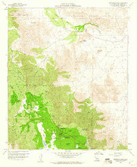
Monument Peak, California, USGS topographic map dated 1959.
Includes geographic coordinates (latitude and longitude). This topographic map is suitable for hiking, camping, and exploring, or framing it as a wall map.
Printed on-demand using high resolution imagery, on heavy weight and acid free paper, or alternatively on a variety of synthetic materials.
Topos available on paper, Waterproof, Poly, or Tyvek. Usually shipping rolled, unless combined with other folded maps in one order.
- Product Number: USGS-5518777
- Free digital map download (high-resolution, GeoPDF): Monument Peak, California (file size: 14 MB)
- Map Size: please refer to the dimensions of the GeoPDF map above
- Weight (paper map): ca. 55 grams
- Map Type: POD USGS Topographic Map
- Map Series: HTMC
- Map Verison: Historical
- Cell ID: 70951
- Scan ID: 293101
- Imprint Year: 1961
- Woodland Tint: Yes
- Aerial Photo Year: 1955
- Field Check Year: 1959
- Datum: NAD27
- Map Projection: Polyconic
- Map published by United States Geological Survey
- Map Language: English
- Scanner Resolution: 600 dpi
- Map Cell Name: Monument Peak
- Grid size: 7.5 X 7.5 Minute
- Date on map: 1959
- Map Scale: 1:24000
- Geographical region: California, United States
Neighboring Maps:
All neighboring USGS topo maps are available for sale online at a variety of scales.
Spatial coverage:
Topo map Monument Peak, California, covers the geographical area associated the following places:
- Chula Vista Reservoir - Filaree Flat - Sundown Mine - El Prado Campground - Mason Valley - Monument Peak - Lucas Creek - Pine Mountain - Los Huecos Reservoir - Boiling Spring Pump - Campbell Ranch - Rancho Vallecito Airport - Garnet Peak - EL Prado Group Camp - Noble Mine - Campbell Grade - Sierra Club Guymon Lodge - Laguna Work Center - Storm Canyon Vista Trailhead - Flathead Flats - Laguna Campground - Taylor Spring - Laguna Meadow - Garnet Mountain - Boiling Spring Ravine - Big Laguna Lake - Garnet Information Center - Pioneer Mail - Salt Creek - Oriflamme Mountain - Mount Laguna Air Force Station - Camp Ole (historical) - Hawi-Vallecito Cultural Preserve - Penny Pines Interpretive Site - The Potrero - Al Bahr Shrine Camp - Cottonwood Canyon - Vallecito Wash - Pepper Tree Spring - Indian Potrero - Laguna Indian Reservation (historical) - Camp Ole Station - Sawtooth Range - Little Laguna Lake - Oasis Spring - Garnet Peak Trail - Troutman Mountain - Stephenson Peak - Horse Heaven Group Camp - Witches Broom Trail - Storm Canyon - El Prado Meadow
- Map Area ID: AREA3332.875-116.5-116.375
- Northwest corner Lat/Long code: USGSNW33-116.5
- Northeast corner Lat/Long code: USGSNE33-116.375
- Southwest corner Lat/Long code: USGSSW32.875-116.5
- Southeast corner Lat/Long code: USGSSE32.875-116.375
- Northern map edge Latitude: 33
- Southern map edge Latitude: 32.875
- Western map edge Longitude: -116.5
- Eastern map edge Longitude: -116.375


