
~ Lockwood Valley CA topo map, 1:24000 scale, 7.5 X 7.5 Minute, Historical, 1943, updated 1967
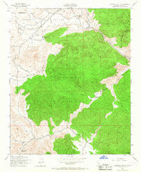
Lockwood Valley, California, USGS topographic map dated 1943.
Includes geographic coordinates (latitude and longitude). This topographic map is suitable for hiking, camping, and exploring, or framing it as a wall map.
Printed on-demand using high resolution imagery, on heavy weight and acid free paper, or alternatively on a variety of synthetic materials.
Topos available on paper, Waterproof, Poly, or Tyvek. Usually shipping rolled, unless combined with other folded maps in one order.
- Product Number: USGS-5517507
- Free digital map download (high-resolution, GeoPDF): Lockwood Valley, California (file size: 13 MB)
- Map Size: please refer to the dimensions of the GeoPDF map above
- Weight (paper map): ca. 55 grams
- Map Type: POD USGS Topographic Map
- Map Series: HTMC
- Map Verison: Historical
- Cell ID: 26204
- Scan ID: 292426
- Imprint Year: 1967
- Woodland Tint: Yes
- Aerial Photo Year: 1942
- Field Check Year: 1943
- Datum: NAD27
- Map Projection: Lambert Conformal Conic
- Map published by United States Geological Survey
- Map published by United States Army Corps of Engineers
- Map published by United States Forest Service
- Map Language: English
- Scanner Resolution: 600 dpi
- Map Cell Name: Lockwood Valley
- Grid size: 7.5 X 7.5 Minute
- Date on map: 1943
- Map Scale: 1:24000
- Geographical region: California, United States
Neighboring Maps:
All neighboring USGS topo maps are available for sale online at a variety of scales.
Spatial coverage:
Topo map Lockwood Valley, California, covers the geographical area associated the following places:
- Lazy T Ranch - Snedden Campground - Mutau Creek - Lockwood Creek Campsite - Kinkaid Cabin (historical) - Sheep Creek - Dalnton Trumbo Ranch - San Guillermo Creek - Long Dave Canyon - Cottonwood Rustic Campsite - Amargosa Creek - Rock Creek - Grade Valley - Ventura County Sheriff's Office - Lockwood Valley Patrol - Negro Creek - Lockwood Campground - Lockwood Valley - Cedar Creek - Mutau Flat - North Fork Lockwood Creek - Lockwood Creek Rustic Campsite - Thorn Meadows - Stonehouse Campground - Little Mutau Creek - Thorn Meadows Campground - Alamo Creek - Snedden Ranch - Sunset Rustic Campsite - Thorn Meadows Guard Station - Cottonwood Campground - Lockwood Peak - Seymour Creek - Half Moon Campground - Sunset Campsite - Middle Fork Lockwood Creek
- Map Area ID: AREA34.7534.625-119.125-119
- Northwest corner Lat/Long code: USGSNW34.75-119.125
- Northeast corner Lat/Long code: USGSNE34.75-119
- Southwest corner Lat/Long code: USGSSW34.625-119.125
- Southeast corner Lat/Long code: USGSSE34.625-119
- Northern map edge Latitude: 34.75
- Southern map edge Latitude: 34.625
- Western map edge Longitude: -119.125
- Eastern map edge Longitude: -119


