
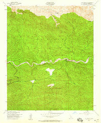
~ Lion Canyon CA topo map, 1:24000 scale, 7.5 X 7.5 Minute, Historical, 1943, updated 1959
Lion Canyon, California, USGS topographic map dated 1943.
Includes geographic coordinates (latitude and longitude). This topographic map is suitable for hiking, camping, and exploring, or framing it as a wall map.
Printed on-demand using high resolution imagery, on heavy weight and acid free paper, or alternatively on a variety of synthetic materials.
Topos available on paper, Waterproof, Poly, or Tyvek. Usually shipping rolled, unless combined with other folded maps in one order.
- Product Number: USGS-5517353
- Free digital map download (high-resolution, GeoPDF): Lion Canyon, California (file size: 15 MB)
- Map Size: please refer to the dimensions of the GeoPDF map above
- Weight (paper map): ca. 55 grams
- Map Type: POD USGS Topographic Map
- Map Series: HTMC
- Map Verison: Historical
- Cell ID: 25856
- Scan ID: 292337
- Imprint Year: 1959
- Woodland Tint: Yes
- Aerial Photo Year: 1942
- Field Check Year: 1943
- Datum: NAD27
- Map Projection: Polyconic
- Map published by United States Geological Survey
- Map published by United States Army Corps of Engineers
- Map Language: English
- Scanner Resolution: 600 dpi
- Map Cell Name: Lion Canyon
- Grid size: 7.5 X 7.5 Minute
- Date on map: 1943
- Map Scale: 1:24000
- Geographical region: California, United States
Neighboring Maps:
All neighboring USGS topo maps are available for sale online at a variety of scales.
Spatial coverage:
Topo map Lion Canyon, California, covers the geographical area associated the following places:
- East Fork Lion Camp - Middle Sespe Trail - Nordhoff Ridge - Three Mile Campsite - Lion Canyon - Trout Creek - Rock Creek - Howard Creek Camp - Rose Valley Falls Camp - Howard Creek - Upper Rose Lake - Ojai Valley Gun Club - Rose Valley Campground - West Fork Lion Camp - Gridley Trail - Rose Lion Trail - Rancho Grande - Rose Valley Station - Pine Mountain Camp - Circle B Ranch - Twin Forks Campsite - Piedra Blanca Civilian Conservation Corps Camp (historical) - Beaver Campground - Piedra Blanca Campsite - Thorn Point - North Fork Piedra Blanca Creek - Pine Mountain Lodge - Lion Campground - Rose Valley Creek - Thacher Cabin - Twin Forks Camp - Beaver Camp - Middle Lion Campground - Middle Lion Campground - Pollard Point - Gore Ranch - Rose Valley - Chief Peak - Three Mile Campground - Piedra Blanca Creek - Rose Valley Falls - Lower Rose Lake - Piedra Blanca - Pine Mountain Lodge Campsite - Piedra Blanca Camp (historical) - Piedra Blanca Camp
- Map Area ID: AREA34.62534.5-119.25-119.125
- Northwest corner Lat/Long code: USGSNW34.625-119.25
- Northeast corner Lat/Long code: USGSNE34.625-119.125
- Southwest corner Lat/Long code: USGSSW34.5-119.25
- Southeast corner Lat/Long code: USGSSE34.5-119.125
- Northern map edge Latitude: 34.625
- Southern map edge Latitude: 34.5
- Western map edge Longitude: -119.25
- Eastern map edge Longitude: -119.125


