
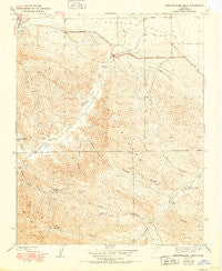
~ Kreyenhagen Hills CA topo map, 1:24000 scale, 7.5 X 7.5 Minute, Historical, 1941, updated 1950
Kreyenhagen Hills, California, USGS topographic map dated 1941.
Includes geographic coordinates (latitude and longitude). This topographic map is suitable for hiking, camping, and exploring, or framing it as a wall map.
Printed on-demand using high resolution imagery, on heavy weight and acid free paper, or alternatively on a variety of synthetic materials.
Topos available on paper, Waterproof, Poly, or Tyvek. Usually shipping rolled, unless combined with other folded maps in one order.
- Product Number: USGS-5516617
- Free digital map download (high-resolution, GeoPDF): Kreyenhagen Hills, California (file size: 13 MB)
- Map Size: please refer to the dimensions of the GeoPDF map above
- Weight (paper map): ca. 55 grams
- Map Type: POD USGS Topographic Map
- Map Series: HTMC
- Map Verison: Historical
- Cell ID: 23995
- Scan ID: 291930
- Imprint Year: 1950
- Survey Year: 1936
- Datum: NAD
- Map Projection: Polyconic
- Map published by United States Geological Survey
- Map Language: English
- Scanner Resolution: 600 dpi
- Map Cell Name: Kreyenhagen Hills
- Grid size: 7.5 X 7.5 Minute
- Date on map: 1941
- Map Scale: 1:24000
- Geographical region: California, United States
Neighboring Maps:
All neighboring USGS topo maps are available for sale online at a variety of scales.
Spatial coverage:
Topo map Kreyenhagen Hills, California, covers the geographical area associated the following places:
- Van Dyke Ranch - Garcia Canyon - Mantes Canyon - Deadman Canyon - Jacalitos Oil Field - Pete Merrill Canyon - Zuburi Ranch - Kreyenhagen Hills - Conn Ranch - Hanes Ranch (historical) - Cedar Canyon - Ruiz Canyon - Johnson Ranch - Arroyo Pinoso - Beltran Creek - Esrey Ranch - Kreyenhagen Ranch
- Map Area ID: AREA36.12536-120.375-120.25
- Northwest corner Lat/Long code: USGSNW36.125-120.375
- Northeast corner Lat/Long code: USGSNE36.125-120.25
- Southwest corner Lat/Long code: USGSSW36-120.375
- Southeast corner Lat/Long code: USGSSE36-120.25
- Northern map edge Latitude: 36.125
- Southern map edge Latitude: 36
- Western map edge Longitude: -120.375
- Eastern map edge Longitude: -120.25


