
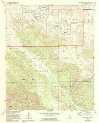
~ Joshua Tree South CA topo map, 1:24000 scale, 7.5 X 7.5 Minute, Historical, 1972, updated 1994
Joshua Tree South, California, USGS topographic map dated 1972.
Includes geographic coordinates (latitude and longitude). This topographic map is suitable for hiking, camping, and exploring, or framing it as a wall map.
Printed on-demand using high resolution imagery, on heavy weight and acid free paper, or alternatively on a variety of synthetic materials.
Topos available on paper, Waterproof, Poly, or Tyvek. Usually shipping rolled, unless combined with other folded maps in one order.
- Product Number: USGS-5516219
- Free digital map download (high-resolution, GeoPDF): Joshua Tree South, California (file size: 14 MB)
- Map Size: please refer to the dimensions of the GeoPDF map above
- Weight (paper map): ca. 55 grams
- Map Type: POD USGS Topographic Map
- Map Series: HTMC
- Map Verison: Historical
- Cell ID: 22826
- Scan ID: 101482
- Imprint Year: 1994
- Woodland Tint: Yes
- Photo Revision Year: 1994
- Aerial Photo Year: 1970
- Field Check Year: 1972
- Datum: NAD27
- Map Projection: Lambert Conformal Conic
- Map published by United States Geological Survey
- Map Language: English
- Scanner Resolution: 600 dpi
- Map Cell Name: Joshua Tree South
- Grid size: 7.5 X 7.5 Minute
- Date on map: 1972
- Map Scale: 1:24000
- Geographical region: California, United States
Neighboring Maps:
All neighboring USGS topo maps are available for sale online at a variety of scales.
Spatial coverage:
Topo map Joshua Tree South, California, covers the geographical area associated the following places:
- KROR-FM (Yucca Valley) - Upper Covington Flat - Cerro de la Silla - Covington Spring - Lower Covington Flat - Joshua Tree Census Designated Place - Nolina Cove - Coyote Hole Spring - La Contenta Junior High School - Quail Springs - Quail Wash - Covington Well - Smith Water Canyon - Friendly Hills Elementary School - West Entrance Station
- Map Area ID: AREA34.12534-116.375-116.25
- Northwest corner Lat/Long code: USGSNW34.125-116.375
- Northeast corner Lat/Long code: USGSNE34.125-116.25
- Southwest corner Lat/Long code: USGSSW34-116.375
- Southeast corner Lat/Long code: USGSSE34-116.25
- Northern map edge Latitude: 34.125
- Southern map edge Latitude: 34
- Western map edge Longitude: -116.375
- Eastern map edge Longitude: -116.25


