
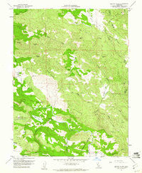
~ Jericho Valley CA topo map, 1:24000 scale, 7.5 X 7.5 Minute, Historical, 1958, updated 1961
Jericho Valley, California, USGS topographic map dated 1958.
Includes geographic coordinates (latitude and longitude). This topographic map is suitable for hiking, camping, and exploring, or framing it as a wall map.
Printed on-demand using high resolution imagery, on heavy weight and acid free paper, or alternatively on a variety of synthetic materials.
Topos available on paper, Waterproof, Poly, or Tyvek. Usually shipping rolled, unless combined with other folded maps in one order.
- Product Number: USGS-5516131
- Free digital map download (high-resolution, GeoPDF): Jericho Valley, California (file size: 17 MB)
- Map Size: please refer to the dimensions of the GeoPDF map above
- Weight (paper map): ca. 55 grams
- Map Type: POD USGS Topographic Map
- Map Series: HTMC
- Map Verison: Historical
- Cell ID: 22547
- Scan ID: 291688
- Imprint Year: 1961
- Woodland Tint: Yes
- Aerial Photo Year: 1957
- Field Check Year: 1958
- Datum: NAD27
- Map Projection: Polyconic
- Map published by United States Geological Survey
- Map Language: English
- Scanner Resolution: 600 dpi
- Map Cell Name: Jericho Valley
- Grid size: 7.5 X 7.5 Minute
- Date on map: 1958
- Map Scale: 1:24000
- Geographical region: California, United States
Neighboring Maps:
All neighboring USGS topo maps are available for sale online at a variety of scales.
Spatial coverage:
Topo map Jericho Valley, California, covers the geographical area associated the following places:
- Hunting Creek - John Thomas Creek - Watson Range - Bishop Mountain - Amel Lake - Butcherknife Creek - Morgan Valley - Jericho Valley - Round Corral - Hennesey Ranch - Gunther Creek - Paradise Valley - Round Mountain - Dunnigan Hill - Jim Dollar Mountain - Norman Springs - Jerusalem Valley - Wildcat Lake - Red Elephant Mine - Ink Ranch - Oat Hill - Jim Davis Peak - Soda Creek - Mysterious Creek - The Cedars - Hells Half Acre - West Coast Radio Receiving Station - Jericho Creek - Pocock Creek - Petticoat Mountain - Hole Creek - Cedar Creek - Bucksnort Creek
- Map Area ID: AREA38.87538.75-122.5-122.375
- Northwest corner Lat/Long code: USGSNW38.875-122.5
- Northeast corner Lat/Long code: USGSNE38.875-122.375
- Southwest corner Lat/Long code: USGSSW38.75-122.5
- Southeast corner Lat/Long code: USGSSE38.75-122.375
- Northern map edge Latitude: 38.875
- Southern map edge Latitude: 38.75
- Western map edge Longitude: -122.5
- Eastern map edge Longitude: -122.375


