
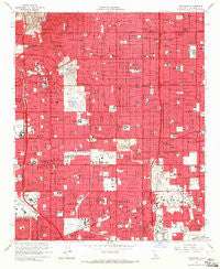
~ Inglewood CA topo map, 1:24000 scale, 7.5 X 7.5 Minute, Historical, 1964, updated 1965
Inglewood, California, USGS topographic map dated 1964.
Includes geographic coordinates (latitude and longitude). This topographic map is suitable for hiking, camping, and exploring, or framing it as a wall map.
Printed on-demand using high resolution imagery, on heavy weight and acid free paper, or alternatively on a variety of synthetic materials.
Topos available on paper, Waterproof, Poly, or Tyvek. Usually shipping rolled, unless combined with other folded maps in one order.
- Product Number: USGS-5515919
- Free digital map download (high-resolution, GeoPDF): Inglewood, California (file size: 13 MB)
- Map Size: please refer to the dimensions of the GeoPDF map above
- Weight (paper map): ca. 55 grams
- Map Type: POD USGS Topographic Map
- Map Series: HTMC
- Map Verison: Historical
- Cell ID: 21931
- Scan ID: 291572
- Imprint Year: 1965
- Aerial Photo Year: 1963
- Edit Year: 1964
- Survey Year: 1923
- Datum: NAD27
- Map Projection: Polyconic
- Map published by United States Geological Survey
- Map Language: English
- Scanner Resolution: 600 dpi
- Map Cell Name: Inglewood
- Grid size: 7.5 X 7.5 Minute
- Date on map: 1964
- Map Scale: 1:24000
- Geographical region: California, United States
Neighboring Maps:
All neighboring USGS topo maps are available for sale online at a variety of scales.
Spatial coverage:
Topo map Inglewood, California, covers the geographical area associated the following places:
- Hyde Park - Lennox - Avalon Gardens - Windsor Hills - Del Aire - Willowbrook - Hermosillo - View Park - West Athens - Bridgedale - Strawberry Park - Van Ness - Inglewood - Moneta - Wildasin - Dorset Village - Athens - Cypave - South Los Angeles - Alondra Park - Lawndale - Gardena - Morningside Park - West Rancho Dominguez - Hawthorne - Delta - Westmont - Wingfoot
- Map Area ID: AREA3433.875-118.375-118.25
- Northwest corner Lat/Long code: USGSNW34-118.375
- Northeast corner Lat/Long code: USGSNE34-118.25
- Southwest corner Lat/Long code: USGSSW33.875-118.375
- Southeast corner Lat/Long code: USGSSE33.875-118.25
- Northern map edge Latitude: 34
- Southern map edge Latitude: 33.875
- Western map edge Longitude: -118.375
- Eastern map edge Longitude: -118.25


