
~ Holtville NE CA topo map, 1:24000 scale, 7.5 X 7.5 Minute, Historical, 1957, updated 1962
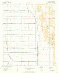
Holtville NE, California, USGS topographic map dated 1957.
Includes geographic coordinates (latitude and longitude). This topographic map is suitable for hiking, camping, and exploring, or framing it as a wall map.
Printed on-demand using high resolution imagery, on heavy weight and acid free paper, or alternatively on a variety of synthetic materials.
Topos available on paper, Waterproof, Poly, or Tyvek. Usually shipping rolled, unless combined with other folded maps in one order.
- Product Number: USGS-5515551
- Free digital map download (high-resolution, GeoPDF): Holtville NE, California (file size: 8 MB)
- Map Size: please refer to the dimensions of the GeoPDF map above
- Weight (paper map): ca. 55 grams
- Map Type: POD USGS Topographic Map
- Map Series: HTMC
- Map Verison: Historical
- Cell ID: 20816
- Scan ID: 291389
- Imprint Year: 1962
- Aerial Photo Year: 1953
- Survey Year: 1957
- Datum: NAD27
- Map Projection: Polyconic
- Map published by United States Geological Survey
- Map Language: English
- Scanner Resolution: 600 dpi
- Map Cell Name: Holtville NE
- Grid size: 7.5 X 7.5 Minute
- Date on map: 1957
- Map Scale: 1:24000
- Geographical region: California, United States
Neighboring Maps:
All neighboring USGS topo maps are available for sale online at a variety of scales.
Spatial coverage:
Topo map Holtville NE, California, covers the geographical area associated the following places:
- Osage Drain - Holtville Seven Drain - Oleander Lateral - Pepper Lateral - Olive Drain - Oasis Lateral - Oxalis Drain - Orita Lateral - Orita Drain - Pomelo Lateral - Holtville Six Drain - Oat Drain - Occident Drain - Ohmar Drain - Orient Lateral - Orange Lateral - Ohmar Lateral - Orange Drain - Oak Lateral - Occident Lateral - Township Drain - Orchid Lateral - Holtville Eight Drain - Oat Lateral - Osage Lateral - Holtville Main Drain - Oak Drain - Pansy Lateral - Orient Drain - Oleander Drain - Pepper Drain - Oasis Drain - Pansy Drain - Township Lateral - Oxalis Lateral - Highline School (historical) - Orita Drain - Holtville Three Drain
- Map Area ID: AREA3332.875-115.375-115.25
- Northwest corner Lat/Long code: USGSNW33-115.375
- Northeast corner Lat/Long code: USGSNE33-115.25
- Southwest corner Lat/Long code: USGSSW32.875-115.375
- Southeast corner Lat/Long code: USGSSE32.875-115.25
- Northern map edge Latitude: 33
- Southern map edge Latitude: 32.875
- Western map edge Longitude: -115.375
- Eastern map edge Longitude: -115.25


