
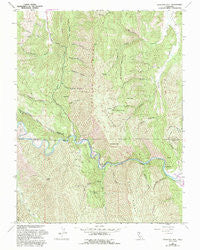
~ Glascock Mtn CA topo map, 1:24000 scale, 7.5 X 7.5 Minute, Historical, 1958, updated 1993
Glascock Mtn, California, USGS topographic map dated 1958.
Includes geographic coordinates (latitude and longitude). This topographic map is suitable for hiking, camping, and exploring, or framing it as a wall map.
Printed on-demand using high resolution imagery, on heavy weight and acid free paper, or alternatively on a variety of synthetic materials.
Topos available on paper, Waterproof, Poly, or Tyvek. Usually shipping rolled, unless combined with other folded maps in one order.
- Product Number: USGS-5514511
- Free digital map download (high-resolution, GeoPDF): Glascock Mtn, California (file size: 16 MB)
- Map Size: please refer to the dimensions of the GeoPDF map above
- Weight (paper map): ca. 55 grams
- Map Type: POD USGS Topographic Map
- Map Series: HTMC
- Map Verison: Historical
- Cell ID: 17367
- Scan ID: 102232
- Imprint Year: 1993
- Woodland Tint: Yes
- Photo Revision Year: 1993
- Aerial Photo Year: 1987
- Edit Year: 1993
- Datum: NAD27
- Map Projection: Lambert Conformal Conic
- Map published by United States Geological Survey
- Map Language: English
- Scanner Resolution: 600 dpi
- Map Cell Name: Glascock Mountain
- Grid size: 7.5 X 7.5 Minute
- Date on map: 1958
- Map Scale: 1:24000
- Geographical region: California, United States
Neighboring Maps:
All neighboring USGS topo maps are available for sale online at a variety of scales.
Spatial coverage:
Topo map Glascock Mtn, California, covers the geographical area associated the following places:
- The Redlands - Buck Flats - Rumsey Canyon - Craig Canyon - Glascock Canyon - Bear Canyon - Langs Peak - Lytle Mountain - Cold Spring - Bear Creek - Still Gulch - Anderson Mountain - Little Sulphur Canyon - Palmer Canyon - Thompson Canyon - Little Sulphur Spring - Bullshead Canyon - Holsten Chimney Canyon - Cache Creek Regional Park - Buck Island - Sulphur Spring - Pocket Canyon - Holsten Canyon - South Jackson Canyon - Pocket Gulch - Camp Haswell - Lawson Canyon - Glascock Spring - Olgert Canyon - Glascock Mountain - Pole Bridge Canyon - Eula Canyon - Billys Hill - Shale Spring Canyon - Brophy Canyon - Fiske Creek
- Map Area ID: AREA3938.875-122.375-122.25
- Northwest corner Lat/Long code: USGSNW39-122.375
- Northeast corner Lat/Long code: USGSNE39-122.25
- Southwest corner Lat/Long code: USGSSW38.875-122.375
- Southeast corner Lat/Long code: USGSSE38.875-122.25
- Northern map edge Latitude: 39
- Southern map edge Latitude: 38.875
- Western map edge Longitude: -122.375
- Eastern map edge Longitude: -122.25


