
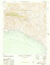
~ El Tranquillon CA topo map, 1:24000 scale, 7.5 X 7.5 Minute, Historical, 1947, updated 1957
El Tranquillon, California, USGS topographic map dated 1947.
Includes geographic coordinates (latitude and longitude). This topographic map is suitable for hiking, camping, and exploring, or framing it as a wall map.
Printed on-demand using high resolution imagery, on heavy weight and acid free paper, or alternatively on a variety of synthetic materials.
Topos available on paper, Waterproof, Poly, or Tyvek. Usually shipping rolled, unless combined with other folded maps in one order.
- Product Number: USGS-5513341
- Free digital map download (high-resolution, GeoPDF): El Tranquillon, California (file size: 11 MB)
- Map Size: please refer to the dimensions of the GeoPDF map above
- Weight (paper map): ca. 55 grams
- Map Type: POD USGS Topographic Map
- Map Series: HTMC
- Map Verison: Historical
- Cell ID: 45560
- Scan ID: 290290
- Imprint Year: 1957
- Woodland Tint: Yes
- Aerial Photo Year: 1946
- Datum: Unstated
- Map Projection: Unstated
- Map published by United States Department of War
- Map Language: English
- Scanner Resolution: 600 dpi
- Map Cell Name: Tranquillon Mountain
- Grid size: 7.5 X 7.5 Minute
- Date on map: 1947
- Map Scale: 1:24000
- Geographical region: California, United States
Neighboring Maps:
All neighboring USGS topo maps are available for sale online at a variety of scales.
Spatial coverage:
Topo map El Tranquillon, California, covers the geographical area associated the following places:
- Lompoc - Cañada Del Jolloru - Sudden Peak - Tranquillon Ridge - Oak Mountain - Sudden - The Espada - Cañada Del Morida - Cañada Del Rodeo - Wild Horse Peak - Sudden Flats - Punta De La Concepcion - Espada Bluff - Cañada Agua Viva - Oil Well Canyon - Sudden Canyon - Water Canyon - Long Horn Canyon - Cypress Ridge - Jalama Beach County Park - Jalama Creek - Tranquillon Mountain - Round Hill - Wild Horse Flat - Cañada De Los Ladrones - Vandenberg Air Force Base Fire Department Station 4 - Cañada De Los Sauces - Vandenberg Air Force Base - Lompoc Air Force Station (historical)
- Map Area ID: AREA34.62534.5-120.625-120.5
- Northwest corner Lat/Long code: USGSNW34.625-120.625
- Northeast corner Lat/Long code: USGSNE34.625-120.5
- Southwest corner Lat/Long code: USGSSW34.5-120.625
- Southeast corner Lat/Long code: USGSSE34.5-120.5
- Northern map edge Latitude: 34.625
- Southern map edge Latitude: 34.5
- Western map edge Longitude: -120.625
- Eastern map edge Longitude: -120.5


