
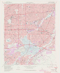
~ El Monte CA topo map, 1:24000 scale, 7.5 X 7.5 Minute, Historical, 1966, updated 1982
El Monte, California, USGS topographic map dated 1966.
Includes geographic coordinates (latitude and longitude). This topographic map is suitable for hiking, camping, and exploring, or framing it as a wall map.
Printed on-demand using high resolution imagery, on heavy weight and acid free paper, or alternatively on a variety of synthetic materials.
Topos available on paper, Waterproof, Poly, or Tyvek. Usually shipping rolled, unless combined with other folded maps in one order.
- Product Number: USGS-5513267
- Free digital map download (high-resolution, GeoPDF): El Monte, California (file size: 19 MB)
- Map Size: please refer to the dimensions of the GeoPDF map above
- Weight (paper map): ca. 55 grams
- Map Type: POD USGS Topographic Map
- Map Series: HTMC
- Map Verison: Historical
- Cell ID: 72676
- Scan ID: 303013
- Imprint Year: 1982
- Photo Revision Year: 1981
- Aerial Photo Year: 1978
- Edit Year: 1981
- Field Check Year: 1966
- Datum: NAD27
- Map Projection: Polyconic
- Planimetric: Yes
- Map published by United States Geological Survey
- Map Language: English
- Scanner Resolution: 600 dpi
- Map Cell Name: El Monte
- Grid size: 7.5 X 7.5 Minute
- Date on map: 1966
- Map Scale: 1:24000
- Geographical region: California, United States
Neighboring Maps:
All neighboring USGS topo maps are available for sale online at a variety of scales.
Spatial coverage:
Topo map El Monte, California, covers the geographical area associated the following places:
- South San Gabriel - East San Gabriel - El Monte - Sibagna (historical) - Wilmar - Rosemead - Savannah (historical) - Monterey Park - Bartolo - North El Monte - Mayflower Village - Montebello - Five Points - Temple City - Maxson - Hayes - Bartolo (historical) - Whittier Junction - South El Monte - East Arcadia - Stoneman - San Gabriel - Clayton (historical) - Ramona Park - San Marino
- Map Area ID: AREA34.12534-118.125-118
- Northwest corner Lat/Long code: USGSNW34.125-118.125
- Northeast corner Lat/Long code: USGSNE34.125-118
- Southwest corner Lat/Long code: USGSSW34-118.125
- Southeast corner Lat/Long code: USGSSE34-118
- Northern map edge Latitude: 34.125
- Southern map edge Latitude: 34
- Western map edge Longitude: -118.125
- Eastern map edge Longitude: -118


