
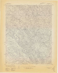
~ Dutchmans Knoll CA topo map, 1:24000 scale, 7.5 X 7.5 Minute, Historical, 1966
Dutchmans Knoll, California, USGS topographic map dated 1966.
Includes geographic coordinates (latitude and longitude). This topographic map is suitable for hiking, camping, and exploring, or framing it as a wall map.
Printed on-demand using high resolution imagery, on heavy weight and acid free paper, or alternatively on a variety of synthetic materials.
Topos available on paper, Waterproof, Poly, or Tyvek. Usually shipping rolled, unless combined with other folded maps in one order.
- Product Number: USGS-5512969
- Free digital map download (high-resolution, GeoPDF): Dutchmans Knoll, California (file size: 16 MB)
- Map Size: please refer to the dimensions of the GeoPDF map above
- Weight (paper map): ca. 55 grams
- Map Type: POD USGS Topographic Map
- Map Series: HTMC
- Map Verison: Historical
- Cell ID: 13179
- Scan ID: 302970
- Datum: Unstated
- Map Projection: Unstated
- Advance: Yes
- Map published by United States Geological Survey
- Keywords: Nonstandard Press Run
- Map Language: English
- Scanner Resolution: 600 dpi
- Map Cell Name: Dutchmans Knoll
- Grid size: 7.5 X 7.5 Minute
- Date on map: 1966
- Map Scale: 1:24000
- Geographical region: California, United States
Neighboring Maps:
All neighboring USGS topo maps are available for sale online at a variety of scales.
Spatial coverage:
Topo map Dutchmans Knoll, California, covers the geographical area associated the following places:
- Blair Gulch - North Fork Ten Mile River - Middle Fork Ten Mile River - Barlow Gulch - Campbell Creek - Smith Creek - South Fork Bear Haven Creek - O'Conner Orchard - Buckhorn Gulch - Horsetail Gulch - Dutchmans Knoll - Gulch Three - Camp Two (historical) - Vallejo Gulch - Buckhorn Creek - Gulch One - Mill Creek - Bald Hill Creek - Little North Fork Ten Mile River - Bucha Ridge - Little Bear Haven Creek - Gulch Two - Buckhorn Ridge - O'Conner Gulch - Cavanough Gulch - Bear Haven Creek - South Fork Ten Mile River
- Map Area ID: AREA39.62539.5-123.75-123.625
- Northwest corner Lat/Long code: USGSNW39.625-123.75
- Northeast corner Lat/Long code: USGSNE39.625-123.625
- Southwest corner Lat/Long code: USGSSW39.5-123.75
- Southeast corner Lat/Long code: USGSSE39.5-123.625
- Northern map edge Latitude: 39.625
- Southern map edge Latitude: 39.5
- Western map edge Longitude: -123.75
- Eastern map edge Longitude: -123.625


