
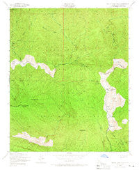
~ Devils Heart Peak CA topo map, 1:24000 scale, 7.5 X 7.5 Minute, Historical, 1943, updated 1966
Devils Heart Peak, California, USGS topographic map dated 1943.
Includes geographic coordinates (latitude and longitude). This topographic map is suitable for hiking, camping, and exploring, or framing it as a wall map.
Printed on-demand using high resolution imagery, on heavy weight and acid free paper, or alternatively on a variety of synthetic materials.
Topos available on paper, Waterproof, Poly, or Tyvek. Usually shipping rolled, unless combined with other folded maps in one order.
- Product Number: USGS-5512433
- Free digital map download (high-resolution, GeoPDF): Devils Heart Peak, California (file size: 15 MB)
- Map Size: please refer to the dimensions of the GeoPDF map above
- Weight (paper map): ca. 55 grams
- Map Type: POD USGS Topographic Map
- Map Series: HTMC
- Map Verison: Historical
- Cell ID: 12097
- Scan ID: 289904
- Imprint Year: 1966
- Woodland Tint: Yes
- Aerial Photo Year: 1942
- Field Check Year: 1943
- Datum: NAD27
- Map Projection: Polyconic
- Map published by United States Geological Survey
- Map published by United States Army Corps of Engineers
- Map Language: English
- Scanner Resolution: 600 dpi
- Map Cell Name: Devils Heart Peak
- Grid size: 7.5 X 7.5 Minute
- Date on map: 1943
- Map Scale: 1:24000
- Geographical region: California, United States
Neighboring Maps:
All neighboring USGS topo maps are available for sale online at a variety of scales.
Spatial coverage:
Topo map Devils Heart Peak, California, covers the geographical area associated the following places:
- Sycamore Canyon - Alder Creek - Alder Creek Camp - Borracho Spring - Stone Corral Creek - Shady Camp - Devils Heart Peak - McDonald Camp - Sespe Condor Sanctuary - Cow Spring - Redrock Creek - Squaw Spring - McDonald Cabin - Cottriel Flat - Cow Springs Campground - Alder Creek Trail - Dough Flat Observation Site - Dough Flat - Coldwater Fork - Condor Observation Site - Coltrell Flat Camp - Squaw Creek - Dripping Springs - Sulphur Peak - Upper Sespe River Trail - Bucksnort Spring - Saddle Skirt Rustic Campsite - East Fork Alder Creek - Stone Corral - Grassy Flat - Ant Campsite - Squaw Flat - Sespe Hot Springs - Pigeon Flat - West Fork Sespe Creek - Hot Springs Canyon - Ant Rustic Campsite - Twilight Mine - Bucksnort Trail - Topatopa Peak
- Map Area ID: AREA34.62534.5-119-118.875
- Northwest corner Lat/Long code: USGSNW34.625-119
- Northeast corner Lat/Long code: USGSNE34.625-118.875
- Southwest corner Lat/Long code: USGSSW34.5-119
- Southeast corner Lat/Long code: USGSSE34.5-118.875
- Northern map edge Latitude: 34.625
- Southern map edge Latitude: 34.5
- Western map edge Longitude: -119
- Eastern map edge Longitude: -118.875


