
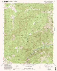
~ Democrat Hot Springs CA topo map, 1:24000 scale, 7.5 X 7.5 Minute, Historical, 1972, updated 1994
Democrat Hot Springs, California, USGS topographic map dated 1972.
Includes geographic coordinates (latitude and longitude). This topographic map is suitable for hiking, camping, and exploring, or framing it as a wall map.
Printed on-demand using high resolution imagery, on heavy weight and acid free paper, or alternatively on a variety of synthetic materials.
Topos available on paper, Waterproof, Poly, or Tyvek. Usually shipping rolled, unless combined with other folded maps in one order.
- Product Number: USGS-5512313
- Free digital map download (high-resolution, GeoPDF): Democrat Hot Springs, California (file size: 18 MB)
- Map Size: please refer to the dimensions of the GeoPDF map above
- Weight (paper map): ca. 55 grams
- Map Type: POD USGS Topographic Map
- Map Series: HTMC
- Map Verison: Historical
- Cell ID: 11917
- Scan ID: 100546
- Imprint Year: 1994
- Woodland Tint: Yes
- Aerial Photo Year: 1970
- Edit Year: 1994
- Field Check Year: 1972
- Datum: NAD27
- Map Projection: Lambert Conformal Conic
- Map published by United States Geological Survey
- Map Language: English
- Scanner Resolution: 600 dpi
- Map Cell Name: Democrat Hot Springs
- Grid size: 7.5 X 7.5 Minute
- Date on map: 1972
- Map Scale: 1:24000
- Geographical region: California, United States
Neighboring Maps:
All neighboring USGS topo maps are available for sale online at a variety of scales.
Spatial coverage:
Topo map Democrat Hot Springs, California, covers the geographical area associated the following places:
- Tucker Creek - Callioud Spring - Mike Harney Canyon - Prefedio Creek - Mormon Canyon - Coffee Creek - Saturday Peak - Saturday Spring Creek - Democrat Guard Station (historical) - Willow Spring - Smith Ranch - Oak Flat - French Ranch - Democrat Spring - Burke Hill - Saturday Spring - Oak Flat Lookout - Diversion Number 1 104-002 Dam - Caughran Spring - Poso Flat - Burke Creek - Little Poso Creek - Oscar Meyer Spring - Willow Spring Creek - Prefedio Spring - Cow Flat Creek - Badger Gap - Canary Spring - Greenhorn School (historical) - Little Tenant Spring - French Ranch Gulch - Hog Hole Spring - China Garden - Big Tenant Spring - Cold Spring - Democrat Hot Springs - Democrat Fire Station - Tenant Creek - Ball Mountain
- Map Area ID: AREA35.62535.5-118.75-118.625
- Northwest corner Lat/Long code: USGSNW35.625-118.75
- Northeast corner Lat/Long code: USGSNE35.625-118.625
- Southwest corner Lat/Long code: USGSSW35.5-118.75
- Southeast corner Lat/Long code: USGSSE35.5-118.625
- Northern map edge Latitude: 35.625
- Southern map edge Latitude: 35.5
- Western map edge Longitude: -118.75
- Eastern map edge Longitude: -118.625


