
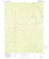
~ Dees Peak CA topo map, 1:24000 scale, 7.5 X 7.5 Minute, Historical, 1978, updated 1988
Dees Peak, California, USGS topographic map dated 1978.
Includes geographic coordinates (latitude and longitude). This topographic map is suitable for hiking, camping, and exploring, or framing it as a wall map.
Printed on-demand using high resolution imagery, on heavy weight and acid free paper, or alternatively on a variety of synthetic materials.
Topos available on paper, Waterproof, Poly, or Tyvek. Usually shipping rolled, unless combined with other folded maps in one order.
- Product Number: USGS-5512263
- Free digital map download (high-resolution, GeoPDF): Dees Peak, California (file size: 11 MB)
- Map Size: please refer to the dimensions of the GeoPDF map above
- Weight (paper map): ca. 55 grams
- Map Type: POD USGS Topographic Map
- Map Series: HTMC
- Map Verison: Historical
- Cell ID: 11793
- Scan ID: 289821
- Imprint Year: 1988
- Woodland Tint: Yes
- Aerial Photo Year: 1972
- Edit Year: 1978
- Field Check Year: 1974
- Datum: NAD27
- Map Projection: Lambert Conformal Conic
- Map published by United States Geological Survey
- Map Language: English
- Scanner Resolution: 600 dpi
- Map Cell Name: Dees Peak
- Grid size: 7.5 X 7.5 Minute
- Date on map: 1978
- Map Scale: 1:24000
- Geographical region: California, United States
Neighboring Maps:
All neighboring USGS topo maps are available for sale online at a variety of scales.
Spatial coverage:
Topo map Dees Peak, California, covers the geographical area associated the following places:
- Hunter Mine - Barritt Cabin - North Fork Eagle Creek - Cinnabar Mine - Fawn Creek - White Rock Mine - Eagle Creek - Mary Blaine Mountain - Virgin Creek - Robbers Roost Mine - South Fork East Fork New River - Sherwood Mine - Emmons Cabin - Marysville - Carey Ridge - Lake City - Mary Blaine Mine - Sherwood Creek - Milk Camp - Potato Mountain - Bake Oven Ridge - Butterfly Flat - Boomer Mine - Virgin Creek Buttes - Milk Creek - Battle Creek - Twomile Creek - Old Denny - Pony Buttes - Turney Spring - Emigrant Creek - Dees Peak - Slide Creek - Brushy Creek - Barron Creek - Uncle Sam Mine - Megram Cabin - Mary Blaine Meadow - Fourmile Creek - Megram Ridge - Virgin Creek Guard Station (historical) - White Rock City - Gunbarrel Mine
- Map Area ID: AREA41.12541-123.375-123.25
- Northwest corner Lat/Long code: USGSNW41.125-123.375
- Northeast corner Lat/Long code: USGSNE41.125-123.25
- Southwest corner Lat/Long code: USGSSW41-123.375
- Southeast corner Lat/Long code: USGSSE41-123.25
- Northern map edge Latitude: 41.125
- Southern map edge Latitude: 41
- Western map edge Longitude: -123.375
- Eastern map edge Longitude: -123.25


