
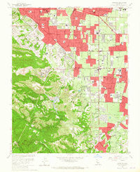
~ Cupertino CA topo map, 1:24000 scale, 7.5 X 7.5 Minute, Historical, 1961, updated 1965
Cupertino, California, USGS topographic map dated 1961.
Includes geographic coordinates (latitude and longitude). This topographic map is suitable for hiking, camping, and exploring, or framing it as a wall map.
Printed on-demand using high resolution imagery, on heavy weight and acid free paper, or alternatively on a variety of synthetic materials.
Topos available on paper, Waterproof, Poly, or Tyvek. Usually shipping rolled, unless combined with other folded maps in one order.
- Product Number: USGS-5511971
- Free digital map download (high-resolution, GeoPDF): Cupertino, California (file size: 15 MB)
- Map Size: please refer to the dimensions of the GeoPDF map above
- Weight (paper map): ca. 55 grams
- Map Type: POD USGS Topographic Map
- Map Series: HTMC
- Map Verison: Historical
- Cell ID: 11042
- Scan ID: 289704
- Imprint Year: 1965
- Woodland Tint: Yes
- Aerial Photo Year: 1960
- Field Check Year: 1961
- Datum: NAD27
- Map Projection: Polyconic
- Map published by United States Geological Survey
- Map Language: English
- Scanner Resolution: 600 dpi
- Map Cell Name: Cupertino
- Grid size: 7.5 X 7.5 Minute
- Date on map: 1961
- Map Scale: 1:24000
- Geographical region: California, United States
Neighboring Maps:
All neighboring USGS topo maps are available for sale online at a variety of scales.
Spatial coverage:
Topo map Cupertino, California, covers the geographical area associated the following places:
- Saratoga - Cupertino - Blossom Valley - Rancho Rinconada - Aloha Mobile Village - Blue Hills - Woodland Acres - Ranchero Thunderbird Mobile Home Court - Cuernavaca - Monta Vista - Champagne Fountain - Loyola Corners - Rancho la Mesa Mobile Home Court - Sunnyvale - Waverly Park - The Highlands - Loyola
- Map Area ID: AREA37.37537.25-122.125-122
- Northwest corner Lat/Long code: USGSNW37.375-122.125
- Northeast corner Lat/Long code: USGSNE37.375-122
- Southwest corner Lat/Long code: USGSSW37.25-122.125
- Southeast corner Lat/Long code: USGSSE37.25-122
- Northern map edge Latitude: 37.375
- Southern map edge Latitude: 37.25
- Western map edge Longitude: -122.125
- Eastern map edge Longitude: -122


