
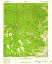
~ Cobblestone Mtn CA topo map, 1:24000 scale, 7.5 X 7.5 Minute, Historical, 1958, updated 1959
Cobblestone Mtn, California, USGS topographic map dated 1958.
Includes geographic coordinates (latitude and longitude). This topographic map is suitable for hiking, camping, and exploring, or framing it as a wall map.
Printed on-demand using high resolution imagery, on heavy weight and acid free paper, or alternatively on a variety of synthetic materials.
Topos available on paper, Waterproof, Poly, or Tyvek. Usually shipping rolled, unless combined with other folded maps in one order.
- Product Number: USGS-5511239
- Free digital map download (high-resolution, GeoPDF): Cobblestone Mtn, California (file size: 16 MB)
- Map Size: please refer to the dimensions of the GeoPDF map above
- Weight (paper map): ca. 55 grams
- Map Type: POD USGS Topographic Map
- Map Series: HTMC
- Map Verison: Historical
- Cell ID: 9369
- Scan ID: 289390
- Imprint Year: 1959
- Woodland Tint: Yes
- Aerial Photo Year: 1942
- Field Check Year: 1943
- Datum: NAD27
- Map Projection: Polyconic
- Map published by United States Geological Survey
- Map published by United States Army Corps of Engineers
- Map Language: English
- Scanner Resolution: 600 dpi
- Map Cell Name: Cobblestone Mountain
- Grid size: 7.5 X 7.5 Minute
- Date on map: 1958
- Map Scale: 1:24000
- Geographical region: California, United States
Neighboring Maps:
All neighboring USGS topo maps are available for sale online at a variety of scales.
Spatial coverage:
Topo map Cobblestone Mtn, California, covers the geographical area associated the following places:
- Slayback Camp (historical) - Canton Canyon - Tin Can Cabin Campground - Michael Creek - Fustero Point - Ellis Apiary Campsite - Cobblestone Trail - Log Cabin Campsite - Agua Blanca Trail - Halfway Spring Campsite - Halfway Spring - Devils Potrero - Hole-in-the-Wall - Whiteacre Peak Trail (historical) - Pothole Spring - Kesters Camp - Blue Point Campground - Pothole Trail - Tin Can Cabin - White Mountain Trail (historical) - Hollister - Cobblestone Mountain - Agua Blanca Camp (historical) - Sulphur Creek - The Pothole - Jayne Ranch (historical) - Blue Point - Cove - Hollister Campground - Lacosca Creek - Devils Gateway - Whiteacre Peak - North Fork Fish Creek - Agua Blanca Creek - Whitaker Ranch - Turtle Canyon - Sharps Canyon - Piru Ranger Station (historical) - Cobblestone Spring - Ruby Canyon - Fish Creek - North Fork Tar Creek - Big Narrows - Cove Campground
- Map Area ID: AREA34.62534.5-118.875-118.75
- Northwest corner Lat/Long code: USGSNW34.625-118.875
- Northeast corner Lat/Long code: USGSNE34.625-118.75
- Southwest corner Lat/Long code: USGSSW34.5-118.875
- Southeast corner Lat/Long code: USGSSE34.5-118.75
- Northern map edge Latitude: 34.625
- Southern map edge Latitude: 34.5
- Western map edge Longitude: -118.875
- Eastern map edge Longitude: -118.75


