
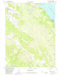
~ Chiles Valley CA topo map, 1:24000 scale, 7.5 X 7.5 Minute, Historical, 1958, updated 1980
Chiles Valley, California, USGS topographic map dated 1958.
Includes geographic coordinates (latitude and longitude). This topographic map is suitable for hiking, camping, and exploring, or framing it as a wall map.
Printed on-demand using high resolution imagery, on heavy weight and acid free paper, or alternatively on a variety of synthetic materials.
Topos available on paper, Waterproof, Poly, or Tyvek. Usually shipping rolled, unless combined with other folded maps in one order.
- Product Number: USGS-5510767
- Free digital map download (high-resolution, GeoPDF): Chiles Valley, California (file size: 12 MB)
- Map Size: please refer to the dimensions of the GeoPDF map above
- Weight (paper map): ca. 55 grams
- Map Type: POD USGS Topographic Map
- Map Series: HTMC
- Map Verison: Historical
- Cell ID: 8524
- Scan ID: 289197
- Imprint Year: 1980
- Woodland Tint: Yes
- Photo Revision Year: 1980
- Aerial Photo Year: 1978
- Edit Year: 1980
- Field Check Year: 1958
- Datum: NAD27
- Map Projection: Polyconic
- Map published by United States Geological Survey
- Map Language: English
- Scanner Resolution: 600 dpi
- Map Cell Name: Chiles Valley
- Grid size: 7.5 X 7.5 Minute
- Date on map: 1958
- Map Scale: 1:24000
- Geographical region: California, United States
Neighboring Maps:
All neighboring USGS topo maps are available for sale online at a variety of scales.
Spatial coverage:
Topo map Chiles Valley, California, covers the geographical area associated the following places:
- Napa County - Linda Vista 2412 Dam - Elder Valley - Rancho Monticello - Soda Valley - Little Sugarloaf Peak - Soda Spring - Johnson Spring - Samuel Springs - Chiles Valley - Lake Berryessa Seaplane Base - Wood Canyon - Schoolhouse Island - Green and Red Vineyard - Putah Creek Park - Chiles Grist Mill - Nichelini Winery - Chiles Valley School (historical) - Smittle Creek - Cedar Roughs - Hardin Creek - Greeg Mountain - Jackson Canyon - Trout Creek Ridge - Husman Canyon - Indian Island - Baldy Mountain - Catacula - Pope Creek - Burton Creek - Robert L Matheson 1413 Dam - Moore Creek - Trout Creek - Iron Mountain - Cedar Roughs Wilderness
- Map Area ID: AREA38.62538.5-122.375-122.25
- Northwest corner Lat/Long code: USGSNW38.625-122.375
- Northeast corner Lat/Long code: USGSNE38.625-122.25
- Southwest corner Lat/Long code: USGSSW38.5-122.375
- Southeast corner Lat/Long code: USGSSE38.5-122.25
- Northern map edge Latitude: 38.625
- Southern map edge Latitude: 38.5
- Western map edge Longitude: -122.375
- Eastern map edge Longitude: -122.25


