
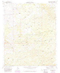
~ Butler Peak CA topo map, 1:24000 scale, 7.5 X 7.5 Minute, Historical, 1971, updated 1988
Butler Peak, California, USGS topographic map dated 1971.
Includes geographic coordinates (latitude and longitude). This topographic map is suitable for hiking, camping, and exploring, or framing it as a wall map.
Printed on-demand using high resolution imagery, on heavy weight and acid free paper, or alternatively on a variety of synthetic materials.
Topos available on paper, Waterproof, Poly, or Tyvek. Usually shipping rolled, unless combined with other folded maps in one order.
- Product Number: USGS-5509565
- Free digital map download (high-resolution, GeoPDF): Butler Peak, California (file size: 11 MB)
- Map Size: please refer to the dimensions of the GeoPDF map above
- Weight (paper map): ca. 55 grams
- Map Type: POD USGS Topographic Map
- Map Series: HTMC
- Map Verison: Historical
- Cell ID: 6468
- Scan ID: 288699
- Imprint Year: 1988
- Woodland Tint: Yes
- Photo Revision Year: 1988
- Aerial Photo Year: 1969
- Field Check Year: 1971
- Datum: NAD27
- Map Projection: Lambert Conformal Conic
- Map published by United States Geological Survey
- Map Language: English
- Scanner Resolution: 600 dpi
- Map Cell Name: Butler Peak
- Grid size: 7.5 X 7.5 Minute
- Date on map: 1971
- Map Scale: 1:24000
- Geographical region: California, United States
Neighboring Maps:
All neighboring USGS topo maps are available for sale online at a variety of scales.
Spatial coverage:
Topo map Butler Peak, California, covers the geographical area associated the following places:
- Big Pine Flat - Chukar Spring - Jackrabbit Spring - White Mountain - Horse Spring Campground - Oak Spring - Butt Rock - West Point - Crafts Peak - Lizard Spring - Muddy Spring - Redonda Ridge - Rattlesnake Spring - Dishpan Spring - Hawes Peak - Cienega Larga - Big Pine Flat Forest Station - Big Pine Flat Campground - Luna Spring - Line Spring - Burns Spring - North Peak - Shay Spring - Crab Creek - Shay Mountain - Horse Spring - Crab Flats - Cox Creek - Little Shay Mountain - Ingham Peak - Hawes Ranch - Holcomb Crossing Group Campground - South Peak White Mountain - Piñon Spring - Deer Mountain - Butler Peak - Lower Larga Flat - Pine Spring - Cox Spring - Sheep Creek - Barrel Spring - Little Pine Flat - Cup Spring - Balanced Rock Mine - Carbine Flat - Hopi Spring - Coxey Meadow - Chipmunk Spring - Mill Spring - Tent Peg Group - Cienega Spring - Liberty Mine - Snow Slide Spring - Ironwood Campsite - Mud Spring - Cienega Redonda - Willow Canyon - Dawn o'Day Canyon - Coyote Flat - Snake Spring - Coxey Ranch (historical) - Rattlesnake Mountain - Devils Hole - Lightning Spring
- Map Area ID: AREA34.37534.25-117.125-117
- Northwest corner Lat/Long code: USGSNW34.375-117.125
- Northeast corner Lat/Long code: USGSNE34.375-117
- Southwest corner Lat/Long code: USGSSW34.25-117.125
- Southeast corner Lat/Long code: USGSSE34.25-117
- Northern map edge Latitude: 34.375
- Southern map edge Latitude: 34.25
- Western map edge Longitude: -117.125
- Eastern map edge Longitude: -117


