
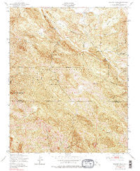
~ Burnett Peak CA topo map, 1:24000 scale, 7.5 X 7.5 Minute, Historical, 1949, updated 1979
Burnett Peak, California, USGS topographic map dated 1949.
Includes geographic coordinates (latitude and longitude). This topographic map is suitable for hiking, camping, and exploring, or framing it as a wall map.
Printed on-demand using high resolution imagery, on heavy weight and acid free paper, or alternatively on a variety of synthetic materials.
Topos available on paper, Waterproof, Poly, or Tyvek. Usually shipping rolled, unless combined with other folded maps in one order.
- Product Number: USGS-5509497
- Free digital map download (high-resolution, GeoPDF): Burnett Peak, California (file size: 22 MB)
- Map Size: please refer to the dimensions of the GeoPDF map above
- Weight (paper map): ca. 55 grams
- Map Type: POD USGS Topographic Map
- Map Series: HTMC
- Map Verison: Historical
- Cell ID: 6296
- Scan ID: 288683
- Imprint Year: 1979
- Woodland Tint: Yes
- Visual Version Number: 1
- Photo Inspection Year: 1976
- Aerial Photo Year: 1947
- Field Check Year: 1949
- Datum: NAD27
- Map Projection: Polyconic
- Map published by United States Geological Survey
- Map published by United States Army Corps of Engineers
- Map published by United States Army
- Map Language: English
- Scanner Resolution: 600 dpi
- Map Cell Name: Burnett Peak
- Grid size: 7.5 X 7.5 Minute
- Date on map: 1949
- Map Scale: 1:24000
- Geographical region: California, United States
Neighboring Maps:
All neighboring USGS topo maps are available for sale online at a variety of scales.
Spatial coverage:
Topo map Burnett Peak, California, covers the geographical area associated the following places:
- Steve Creek - Quicksilver Mine - Beartrap Flat - Crystal Knob - Los Burros Creek - South Fork Waller Creek - Sycamore Reservoir Dam - Piedras Altas - Sycamore Creek - Oak Flat - Burnett Peak - Italian Flat - Twin Valley Creek - The Pallsades - El Piojo Reservoir Dam - The Shut-in - Little Oak Flat - Pozo Hondo Creek - El Piojo Creek - Waller Creek - Salmon Creek - Davis Ranch (historical) - Bull Canyon
- Map Area ID: AREA35.87535.75-121.25-121.125
- Northwest corner Lat/Long code: USGSNW35.875-121.25
- Northeast corner Lat/Long code: USGSNE35.875-121.125
- Southwest corner Lat/Long code: USGSSW35.75-121.25
- Southeast corner Lat/Long code: USGSSE35.75-121.125
- Northern map edge Latitude: 35.875
- Southern map edge Latitude: 35.75
- Western map edge Longitude: -121.25
- Eastern map edge Longitude: -121.125


