
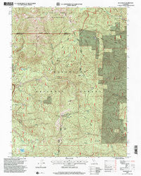
~ Buck Rock CA topo map, 1:24000 scale, 7.5 X 7.5 Minute, Historical, 1995, updated 2001
Buck Rock, California, USGS topographic map dated 1995.
Includes geographic coordinates (latitude and longitude). This topographic map is suitable for hiking, camping, and exploring, or framing it as a wall map.
Printed on-demand using high resolution imagery, on heavy weight and acid free paper, or alternatively on a variety of synthetic materials.
Topos available on paper, Waterproof, Poly, or Tyvek. Usually shipping rolled, unless combined with other folded maps in one order.
- Product Number: USGS-5509359
- Free digital map download (high-resolution, GeoPDF): Buck Rock, California (file size: 19 MB)
- Map Size: please refer to the dimensions of the GeoPDF map above
- Weight (paper map): ca. 55 grams
- Map Type: POD USGS Topographic Map
- Map Series: HTMC
- Map Verison: Historical
- Cell ID: 5887
- Scan ID: 100513
- Imprint Year: 2001
- Woodland Tint: Yes
- Aerial Photo Year: 1993
- Datum: NAD27
- Map Projection: Lambert Conformal Conic
- Map published by United States Geological Survey
- Map published by United States Forest Service
- Map Language: English
- Scanner Resolution: 600 dpi
- Map Cell Name: Buck Rock
- Grid size: 7.5 X 7.5 Minute
- Date on map: 1995
- Map Scale: 1:24000
- Geographical region: California, United States
Neighboring Maps:
All neighboring USGS topo maps are available for sale online at a variety of scales.
Spatial coverage:
Topo map Buck Rock, California, covers the geographical area associated the following places:
- Summit Trail - Doll Camp - Smoke Howe Trail - Ant Ridge - Pony Ridge - Pony Meadows - Little Buck Rock - Green Springs - Doll Creek - Short Ridge - Hammerhorn Lake - Slanes Flat Ridge - Willow Spring - Irish Glade - Buck Rock Creek - Sugar Ridge - Beaver Glade Station - Doll Ridge - Alder Creek - Hammerhorn Ridge - Minnie Glade - Buck Rock - Hammerhorn Campground - Slanes Flat - Bear Wallow - Smokehouse Creek - Tantrum Glade Guard Station (historical) - Forks Ridge - Elk Ridge - Howard Lake - Croney Ridge - Henderson Cabin (historical) - Little Doe Ridge - Elk Lake - Little Doe Campground - Smokehouse Ridge - Cherry Lake
- Map Area ID: AREA4039.875-123-122.875
- Northwest corner Lat/Long code: USGSNW40-123
- Northeast corner Lat/Long code: USGSNE40-122.875
- Southwest corner Lat/Long code: USGSSW39.875-123
- Southeast corner Lat/Long code: USGSSE39.875-122.875
- Northern map edge Latitude: 40
- Southern map edge Latitude: 39.875
- Western map edge Longitude: -123
- Eastern map edge Longitude: -122.875


