
~ Black Lassic CA topo map, 1:24000 scale, 7.5 X 7.5 Minute, Historical, 1979, updated 1979
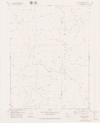
Black Lassic, California, USGS topographic map dated 1979.
Includes geographic coordinates (latitude and longitude). This topographic map is suitable for hiking, camping, and exploring, or framing it as a wall map.
Printed on-demand using high resolution imagery, on heavy weight and acid free paper, or alternatively on a variety of synthetic materials.
Topos available on paper, Waterproof, Poly, or Tyvek. Usually shipping rolled, unless combined with other folded maps in one order.
- Product Number: USGS-5508675
- Free digital map download (high-resolution, GeoPDF): Black Lassic, California (file size: 6 MB)
- Map Size: please refer to the dimensions of the GeoPDF map above
- Weight (paper map): ca. 55 grams
- Map Type: POD USGS Topographic Map
- Map Series: HTMC
- Map Verison: Historical
- Cell ID: 4143
- Scan ID: 302426
- Imprint Year: 1979
- Visual Version Number: 1
- Aerial Photo Year: 1972
- Edit Year: 1979
- Field Check Year: 1973
- Datum: NAD27
- Map Projection: Lambert Conformal Conic
- Planimetric: Yes
- Map published by United States Geological Survey
- Map Language: English
- Scanner Resolution: 600 dpi
- Map Cell Name: Black Lassic
- Grid size: 7.5 X 7.5 Minute
- Date on map: 1979
- Map Scale: 1:24000
- Geographical region: California, United States
Neighboring Maps:
All neighboring USGS topo maps are available for sale online at a variety of scales.
Spatial coverage:
Topo map Black Lassic, California, covers the geographical area associated the following places:
- Bear Creek - Red Lassic - North Fork Conley Creek - Mule Slide - Mule Ridge - Dutchman Camp - Lost Ridge - Perry Salt Log - Signal Peak - Coffee Pot - Alder Spring - Goat Spring - Summit Flat - Big Meadows Springs - Charles Mountain - Lassics Lookout - Pine Mountain - Lost Lake - Black Lassic - Mount Lassic Wilderness - Big Meadow Springs - Goat Hill - Blanket Creek - Goat Rock - Devils Gut - Big Meadow Camp (historical) - Red Rock - Lost Canyon - Dolores Creek - Fingal Ranch - Freezeout - Senteney Rock - Dry Lake - Goat Camp (historical) - Summit Camp (historical) - South Fork Conley Creek - Buck Pasture
- Map Area ID: AREA40.37540.25-123.625-123.5
- Northwest corner Lat/Long code: USGSNW40.375-123.625
- Northeast corner Lat/Long code: USGSNE40.375-123.5
- Southwest corner Lat/Long code: USGSSW40.25-123.625
- Southeast corner Lat/Long code: USGSSE40.25-123.5
- Northern map edge Latitude: 40.375
- Southern map edge Latitude: 40.25
- Western map edge Longitude: -123.625
- Eastern map edge Longitude: -123.5


