
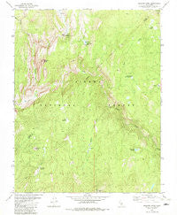
~ Balloon Dome CA topo map, 1:24000 scale, 7.5 X 7.5 Minute, Historical, 1982, updated 1982
Balloon Dome, California, USGS topographic map dated 1982.
Includes geographic coordinates (latitude and longitude). This topographic map is suitable for hiking, camping, and exploring, or framing it as a wall map.
Printed on-demand using high resolution imagery, on heavy weight and acid free paper, or alternatively on a variety of synthetic materials.
Topos available on paper, Waterproof, Poly, or Tyvek. Usually shipping rolled, unless combined with other folded maps in one order.
- Product Number: USGS-5508015
- Free digital map download (high-resolution, GeoPDF): Balloon Dome, California (file size: 13 MB)
- Map Size: please refer to the dimensions of the GeoPDF map above
- Weight (paper map): ca. 55 grams
- Map Type: POD USGS Topographic Map
- Map Series: HTMC
- Map Verison: Historical
- Cell ID: 2273
- Scan ID: 288192
- Imprint Year: 1982
- Woodland Tint: Yes
- Aerial Photo Year: 1976
- Edit Year: 1982
- Field Check Year: 1978
- Datum: NAD27
- Map Projection: Lambert Conformal Conic
- Map published by United States Geological Survey
- Map published by United States Forest Service
- Map Language: English
- Scanner Resolution: 600 dpi
- Map Cell Name: Balloon Dome
- Grid size: 7.5 X 7.5 Minute
- Date on map: 1982
- Map Scale: 1:24000
- Geographical region: California, United States
Neighboring Maps:
All neighboring USGS topo maps are available for sale online at a variety of scales.
Spatial coverage:
Topo map Balloon Dome, California, covers the geographical area associated the following places:
- Cow Meadow - Miller Creek - South Fork San Joaquin River - Hoffman Meadow - Granite Creek - Heitz Meadow Forest Service Station - Rock Creek - Balloon Dome - Mount Tom Lookout - Mount Tom - Hoffman Creek - Mill Creek Meadow - Rube Meadow - Bear Meadow - Rube Creek - Cassidy Bridge - Cassidy Meadows - Crater Lake Meadow - Rattlesnake Lake - Lower Miller Crossing - Brown Cone
- Map Area ID: AREA37.537.375-119.25-119.125
- Northwest corner Lat/Long code: USGSNW37.5-119.25
- Northeast corner Lat/Long code: USGSNE37.5-119.125
- Southwest corner Lat/Long code: USGSSW37.375-119.25
- Southeast corner Lat/Long code: USGSSE37.375-119.125
- Northern map edge Latitude: 37.5
- Southern map edge Latitude: 37.375
- Western map edge Longitude: -119.25
- Eastern map edge Longitude: -119.125


