
~ Antelope Lake CA topo map, 1:24000 scale, 7.5 X 7.5 Minute, Historical, 1972, updated 1974
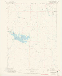
Antelope Lake, California, USGS topographic map dated 1972.
Includes geographic coordinates (latitude and longitude). This topographic map is suitable for hiking, camping, and exploring, or framing it as a wall map.
Printed on-demand using high resolution imagery, on heavy weight and acid free paper, or alternatively on a variety of synthetic materials.
Topos available on paper, Waterproof, Poly, or Tyvek. Usually shipping rolled, unless combined with other folded maps in one order.
- Product Number: USGS-5507517
- Free digital map download (high-resolution, GeoPDF): Antelope Lake, California (file size: 6 MB)
- Map Size: please refer to the dimensions of the GeoPDF map above
- Weight (paper map): ca. 55 grams
- Map Type: POD USGS Topographic Map
- Map Series: HTMC
- Map Verison: Historical
- Cell ID: 1149
- Scan ID: 302259
- Imprint Year: 1974
- Visual Version Number: 1
- Aerial Photo Year: 1965
- Field Check Year: 1972
- Datum: NAD27
- Map Projection: Lambert Conformal Conic
- Planimetric: Yes
- Map published by United States Geological Survey
- Map Language: English
- Scanner Resolution: 600 dpi
- Map Cell Name: Antelope Lake
- Grid size: 7.5 X 7.5 Minute
- Date on map: 1972
- Map Scale: 1:24000
- Geographical region: California, United States
Neighboring Maps:
All neighboring USGS topo maps are available for sale online at a variety of scales.
Spatial coverage:
Topo map Antelope Lake, California, covers the geographical area associated the following places:
- Doctor Smith Flat - Thompson Creek - Antelope Valley Dam - Harwood Cabin - Antelope Valley Reservoir - Boulder Creek Campground - Dry Flat - Dedication Island - Pioneer Cabin - Clarks Peak - Boulder Creek - Wildcat Ridge - Lost Creek - Antelope Valley - Long Point - Cold Stream - Long Point Campground - Wemple Cabin - Antelope Creek - Frazier Cabin - Boulder Creek Work Center - Bootsole Creek - Cradle Valley - Little Antelope Creek - Antelope 1-050 Dam - Lower Lone Rock Valley - Lone Rock Campground - Lone Rock Creek - Lost Cove Picnic Area - Antelope Lake - Hallett Meadow - Chipmunk Spring
- Map Area ID: AREA40.2540.125-120.625-120.5
- Northwest corner Lat/Long code: USGSNW40.25-120.625
- Northeast corner Lat/Long code: USGSNE40.25-120.5
- Southwest corner Lat/Long code: USGSSW40.125-120.625
- Southeast corner Lat/Long code: USGSSE40.125-120.5
- Northern map edge Latitude: 40.25
- Southern map edge Latitude: 40.125
- Western map edge Longitude: -120.625
- Eastern map edge Longitude: -120.5


