
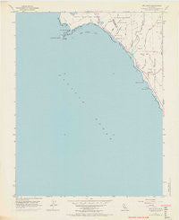
~ Ano Nuevo CA topo map, 1:24000 scale, 7.5 X 7.5 Minute, Historical, 1955, updated 1969
Ano Nuevo, California, USGS topographic map dated 1955.
Includes geographic coordinates (latitude and longitude). This topographic map is suitable for hiking, camping, and exploring, or framing it as a wall map.
Printed on-demand using high resolution imagery, on heavy weight and acid free paper, or alternatively on a variety of synthetic materials.
Topos available on paper, Waterproof, Poly, or Tyvek. Usually shipping rolled, unless combined with other folded maps in one order.
- Product Number: USGS-5507509
- Free digital map download (high-resolution, GeoPDF): Ano Nuevo, California (file size: 17 MB)
- Map Size: please refer to the dimensions of the GeoPDF map above
- Weight (paper map): ca. 55 grams
- Map Type: POD USGS Topographic Map
- Map Series: HTMC
- Map Verison: Historical
- Cell ID: 1086
- Scan ID: 302258
- Imprint Year: 1969
- Visual Version Number: 1
- Photo Revision Year: 1968
- Aerial Photo Year: 1968
- Field Check Year: 1955
- Datum: NAD27
- Map Projection: Polyconic
- Planimetric: Yes
- Special Printing: Yes
- Map published by United States Geological Survey
- Map Language: English
- Scanner Resolution: 600 dpi
- Map Cell Name: Point Ano Nuevo
- Grid size: 7.5 X 7.5 Minute
- Date on map: 1955
- Map Scale: 1:24000
- Geographical region: California, United States
Neighboring Maps:
All neighboring USGS topo maps are available for sale online at a variety of scales.
Spatial coverage:
Topo map Ano Nuevo, California, covers the geographical area associated the following places:
- Canada de la Salud - Laguna de las Trancas - Año Nuevo Creek - Las Trancas Airport - Green Oaks Creek - China Ladder - Rancho Del Oso (historical) - Coastways 1600 Dam - Cold Dip Creek - Año Nuevo Bay - Horse Trail Camp - Finney Creek - Wilson Gulch - Año Nuevo Island - Point Año Nuevo - Greyhound Rock Fishing Access - Elliot Creek - Theodore J. Hoover Natural Preserve - Rancho del Osos Nature and History Center - Coastways Ranch - Waddell Creek - Twin Redwoods Trail Camp - Marsh Trail - Arroyo Las Trancas - Green Oaks Number 1 1604-002 Dam - La Carbonera - Greyhound Rock - Waddell Creek Beach - Pelican Rock - Cove Beach - Alder Trail Camp - China Ladder Beach
- Map Area ID: AREA37.12537-122.375-122.25
- Northwest corner Lat/Long code: USGSNW37.125-122.375
- Northeast corner Lat/Long code: USGSNE37.125-122.25
- Southwest corner Lat/Long code: USGSSW37-122.375
- Southeast corner Lat/Long code: USGSSE37-122.25
- Northern map edge Latitude: 37.125
- Southern map edge Latitude: 37
- Western map edge Longitude: -122.375
- Eastern map edge Longitude: -122.25


