
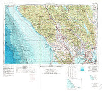
~ Santa Rosa CA topo map, 1:250000 scale, 1 X 2 Degree, Historical, 1958, updated 1980
Santa Rosa, California, USGS topographic map dated 1958.
Includes geographic coordinates (latitude and longitude). This topographic map is suitable for hiking, camping, and exploring, or framing it as a wall map.
Printed on-demand using high resolution imagery, on heavy weight and acid free paper, or alternatively on a variety of synthetic materials.
Topos available on paper, Waterproof, Poly, or Tyvek. Usually shipping rolled, unless combined with other folded maps in one order.
- Product Number: USGS-5506749
- Free digital map download (high-resolution, GeoPDF): Santa Rosa, California (file size: 28 MB)
- Map Size: please refer to the dimensions of the GeoPDF map above
- Weight (paper map): ca. 55 grams
- Map Type: POD USGS Topographic Map
- Map Series: HTMC
- Map Verison: Historical
- Cell ID: 74995
- Scan ID: 302158
- Imprint Year: 1980
- Woodland Tint: Yes
- Edit Year: 1970
- Field Check Year: 1958
- Datum: NAD27
- Map Projection: Transverse Mercator
- Map published by United States Geological Survey
- Map published by United States Department of Commerce
- Map Language: English
- Scanner Resolution: 600 dpi
- Map Cell Name: Santa Rosa
- Grid size: 1 X 2 Degree
- Date on map: 1958
- Map Scale: 1:250000
- Geographical region: California, United States
Neighboring Maps:
All neighboring USGS topo maps are available for sale online at a variety of scales.
Spatial coverage:
Topo map Santa Rosa, California, covers the geographical area associated the following places:
- Rockville - Thomasson - Crolona Heights - Novato - Rohnert Park - Cadwell - Mission Highlands - Wilfred - Monticello (historical) - Sobrante - Marinwood - Fetters Hot Springs - Brazos - Rumsey - Taylorville (historical) - Truth Home - Kelseyville - Rancho Vista Mobile Home Park - Dillon Beach - Embarcadero - Toners Place - Haystack - Riviera Estates - Tolenas - Mailliard (historical) - Sears Point - Yountville - Cozzens Corner - Bodega - Villa Grande - Guernewood Park - Benicia - Bucktown - Liberty - Signal Port (historical) - Duncans Mills - Castle Rock Springs - Deer Park - Two Rock - Crockett - Goat Rock - Rio Dell - Ingram - Rio Nido - Sleepy Hollow - Glenbrook - Northwood Heights - Sonoma Vista - Bale - Selby - Five Brooks - Ettawa Springs - Crown - Terra Linda - Alliance Redwood - Knoxville - Adams - Monsanto - Pine Grove - Mirabel (historical) - Mount Hannah Lodge - Clearlake - Walter Springs - Guenoc (historical) - South Santa Rosa - Ohmer (historical) - Hamlet - Windsor - Blakes Landing - Hardin (historical) - San Geronimo - Cordelia Junction - Bonilla - Nicks Cove - Park Creek Village Mobile Home Park - Napa - Tancred - Sulphur Springs (historical) - Sonoma - Graton - Middletown - Whispering Pines - Suisun - Saint Helena - Pinole - Los Guilicos - Calistoga - Highland Springs - Bodega Bay - Sacramento Landing - Gravenstein - Dawes - Martinez - Pieta - Seigler Springs - McNear - Forest Lake - Enchanted Hills - Cotati - Guinda
- Map Area ID: AREA3938-124-122
- Northwest corner Lat/Long code: USGSNW39-124
- Northeast corner Lat/Long code: USGSNE39-122
- Southwest corner Lat/Long code: USGSSW38-124
- Southeast corner Lat/Long code: USGSSE38-122
- Northern map edge Latitude: 39
- Southern map edge Latitude: 38
- Western map edge Longitude: -124
- Eastern map edge Longitude: -122


