
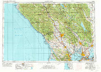
~ Santa Rosa CA topo map, 1:250000 scale, 1 X 2 Degree, Historical, 1958, updated 1973
Santa Rosa, California, USGS topographic map dated 1958.
Includes geographic coordinates (latitude and longitude). This topographic map is suitable for hiking, camping, and exploring, or framing it as a wall map.
Printed on-demand using high resolution imagery, on heavy weight and acid free paper, or alternatively on a variety of synthetic materials.
Topos available on paper, Waterproof, Poly, or Tyvek. Usually shipping rolled, unless combined with other folded maps in one order.
- Product Number: USGS-5506747
- Free digital map download (high-resolution, GeoPDF): Santa Rosa, California (file size: 25 MB)
- Map Size: please refer to the dimensions of the GeoPDF map above
- Weight (paper map): ca. 55 grams
- Map Type: POD USGS Topographic Map
- Map Series: HTMC
- Map Verison: Historical
- Cell ID: 74995
- Scan ID: 302157
- Imprint Year: 1973
- Woodland Tint: Yes
- Aerial Photo Year: 1954
- Edit Year: 1970
- Field Check Year: 1958
- Datum: Unstated
- Map Projection: Transverse Mercator
- Map published by: Military, Other
- Map Language: English
- Scanner Resolution: 600 dpi
- Map Cell Name: Santa Rosa
- Grid size: 1 X 2 Degree
- Date on map: 1958
- Map Scale: 1:250000
- Geographical region: California, United States
Neighboring Maps:
All neighboring USGS topo maps are available for sale online at a variety of scales.
Spatial coverage:
Topo map Santa Rosa, California, covers the geographical area associated the following places:
- Camp Thayer - Hale Place - Thomasson - Gualala - Pierce - Occidental - Montesano - Ross - Pope Valley - Beltaine (historical) - Wilson Grove - Bodega Bay - Lucas Valley - Manzana - Valona - Donahue (historical) - Oakville - Buchli - Iverson Indian Rancheria - Riccas Corner - Seahaven - Port Chicago (historical) - Gallaway - Blakes Landing - Terra Lindo - Geyserville - Atlas - Stewarts Point - Shellville Colony - Cordelia - Veteran Heights - Jacksnipe - Vallejo - Vincent Landing - Rohnert Park - Bivalve - Las Lomas - Guenoc (historical) - Mankas Corner - Monticello (historical) - Temelec - Napa Abajo - Hopyard (historical) - Carquinez Heights - Alderglen Springs - Pinole - Yountville - Mount Jackson - El Verano - Thoman - Nicks Cove - Duncan Springs - Spanish Flat Resort - Noel Heights - South Vallejo - Pieta - Big Bend - Lombard - Harry Floyd Terrace - Roblar - Martinez - Old Ornbaun Hot Springs - Nervo - Denman (historical) - Bridgehaven - Rio Nido - Melita - Crockett - Collins - Montgomery Village - Sanitarium - Esparto - Gallinas - Ettawa Springs - Monte Rosa - Terra Linda - Mirabel Heights - Guernewood - Odd Fellows Park - Simi - Agua Caliente - Flosden Acres - Merazo - Orchard - Millerton - Salvador - Old Hopland - Las Gallinas - Los Guilicos - Green Valley - Anchor Bay - McNear - Mirabel (historical) - Oasis - Berryessa Highlands - Pine Grove - Ramal - Williams (historical) - Novato - Bonanza Springs
- Map Area ID: AREA3938-124-122
- Northwest corner Lat/Long code: USGSNW39-124
- Northeast corner Lat/Long code: USGSNE39-122
- Southwest corner Lat/Long code: USGSSW38-124
- Southeast corner Lat/Long code: USGSSE38-122
- Northern map edge Latitude: 39
- Southern map edge Latitude: 38
- Western map edge Longitude: -124
- Eastern map edge Longitude: -122


