
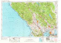
~ Santa Rosa CA topo map, 1:250000 scale, 1 X 2 Degree, Historical, 1958, updated 1968
Santa Rosa, California, USGS topographic map dated 1958.
Includes geographic coordinates (latitude and longitude). This topographic map is suitable for hiking, camping, and exploring, or framing it as a wall map.
Printed on-demand using high resolution imagery, on heavy weight and acid free paper, or alternatively on a variety of synthetic materials.
Topos available on paper, Waterproof, Poly, or Tyvek. Usually shipping rolled, unless combined with other folded maps in one order.
- Product Number: USGS-5506745
- Free digital map download (high-resolution, GeoPDF): Santa Rosa, California (file size: 25 MB)
- Map Size: please refer to the dimensions of the GeoPDF map above
- Weight (paper map): ca. 55 grams
- Map Type: POD USGS Topographic Map
- Map Series: HTMC
- Map Verison: Historical
- Cell ID: 74995
- Scan ID: 302156
- Imprint Year: 1968
- Woodland Tint: Yes
- Edit Year: 1967
- Field Check Year: 1958
- Datum: Unstated
- Map Projection: Transverse Mercator
- Map published by United States Army Corps of Engineers
- Map published by United States Army
- Map Language: English
- Scanner Resolution: 600 dpi
- Map Cell Name: Santa Rosa
- Grid size: 1 X 2 Degree
- Date on map: 1958
- Map Scale: 1:250000
- Geographical region: California, United States
Neighboring Maps:
All neighboring USGS topo maps are available for sale online at a variety of scales.
Spatial coverage:
Topo map Santa Rosa, California, covers the geographical area associated the following places:
- Enchanted Hills - Thoman - Glenbrook - Odd Fellows Park - Annapolis - Llano - El Verano - Green Valley - Makahmo (historical) - Lucas Valley - Country Villa Estates - Woolsey - Castle Rock Springs - Tomales - Subeet - East Windsor - Salminas Resort - Fulton - Sheridan - Fairville - Orchard - Glencove - Sleepy Hollow - Fallon - Rolands - Knoxville - Clearlake Park - Mount Hannah Lodge - Penngrove - Cazadero - Valona - Riccas Corner - Wingo - Clima - Bonanza Springs - Napa Junction - Sea Ranch - Kellogg - Edendale - Gravenstein - Rancho Ramon Mobile Home Park - Flosden (historical) - Blakes Landing - Chiquita - Manzana - Atlas - Northwood - Stanley - Mount Jackson - Ramal - Hamlet - Boyes Hot Springs - Angwin - Buchli - Stewarts Point - Willota - Luzon - Chabot Terrace - Highcroft - Verano - Caymus (historical) - Harry Floyd Terrace - Hobergs - Tyrone - Nervo - Temelec - Lokoya - Cypress Grove - Crolona Heights - Rio Nido - Fish Rock - Montgomery Village - Ozol - Valley Crossing - Mailliard (historical) - Duncan Springs - Bale - Rocktram - El Bonita - Aetna Springs - Camp Meeker - Montesano - Brooks - Goat Rock - Harbin Springs Annex - Eldridge - Omus - Miller (historical) - Anchor Bay - Dorr Place - Lacresta (historical) - Spanish Flat Resort - Tolenas - Pine Grove - Old Ornbaun Hot Springs - Maltby - Woodacre - Bel Marin Keys - Rutherford - Pope Valley
- Map Area ID: AREA3938-124-122
- Northwest corner Lat/Long code: USGSNW39-124
- Northeast corner Lat/Long code: USGSNE39-122
- Southwest corner Lat/Long code: USGSSW38-124
- Southeast corner Lat/Long code: USGSSE38-122
- Northern map edge Latitude: 39
- Southern map edge Latitude: 38
- Western map edge Longitude: -124
- Eastern map edge Longitude: -122


