
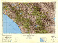
~ Santa Ana CA topo map, 1:250000 scale, 1 X 2 Degree, Historical, 1947, updated 1949
Santa Ana, California, USGS topographic map dated 1947.
Includes geographic coordinates (latitude and longitude). This topographic map is suitable for hiking, camping, and exploring, or framing it as a wall map.
Printed on-demand using high resolution imagery, on heavy weight and acid free paper, or alternatively on a variety of synthetic materials.
Topos available on paper, Waterproof, Poly, or Tyvek. Usually shipping rolled, unless combined with other folded maps in one order.
- Product Number: USGS-5506725
- Free digital map download (high-resolution, GeoPDF): Santa Ana, California (file size: 15 MB)
- Map Size: please refer to the dimensions of the GeoPDF map above
- Weight (paper map): ca. 55 grams
- Map Type: POD USGS Topographic Map
- Map Series: HTMC
- Map Verison: Historical
- Cell ID: 69016
- Scan ID: 707589
- Imprint Year: 1949
- Woodland Tint: Yes
- Aerial Photo Year: 1944
- Datum: NAD27
- Map Projection: Transverse Mercator
- Shaded Relief map: Yes
- Map published by United States Geological Survey
- Map Language: English
- Scanner Resolution: 508 dpi
- Map Cell Name: Santa Ana
- Grid size: 1 X 2 Degree
- Date on map: 1947
- Map Scale: 1:250000
- Geographical region: California, United States
Neighboring Maps:
All neighboring USGS topo maps are available for sale online at a variety of scales.
Spatial coverage:
Topo map Santa Ana, California, covers the geographical area associated the following places:
- Holiday Home Mobile Home Park - Smeltzer - Rancho Carlsbad Trailer Park - Liberty Mobile Home Court - Huntington Mobile Home Estates - Aguanga - Villa Grande Mobile Home Park - Prado Verde Mobile Home Park - Carefree Mobile Village - Rancho Casitas Mobile Home Park - Hinda - Anaheim Shores - Canyon Crest Heights - La Cresta Highlands - Del Prado Mobile Park Club - Green Valley Mobile Home Park - Casitas del Sol Mobile Home Park - Bellview Park Mobile Home Park - Arcilla - Mons - La Jolla Amago - California Mobile Home Park - Gilman Hot Springs - Citrus Gardens Mobile Home Park - Martinez - West Anaheim Junction - Eldorado Mobile Home Estates - Fern Valley - Rancho del Avion Capistrano Mobile Home Park - Eastvale - Caliente Sands - Royal Palms - Sunny Hills - Sandalwood Mobile Home Park - Ballena - Galivan - Wanda (historical) - Prenda - Madrid Manor Mobile Home Park - Ocean Breeze Trailer Park - Town and Country Villa - Sky Valley Mobile Home Park - The Meadows - Borrego Springs - Oceanside - Quail Valley - Carbondale (historical) - Menifee - Bolsa Verde - Los Ranchitos - Bly - Garnet - Katella Mobile Home Estates - Olive - Del Ray Mobile Home Estates - Villa Valencia - San Juan Capistrano - Ellis - Arabian Gardens Mobile Home Park - Leucadia - Beaumont - Desert Groves Mobile Home Park - De Luz Heights - La Sierra Heights - Wynola - Whispering Pines - Ladera Ranch - Ponderosa Mobile Home Estates - Green Lantern Village - Orange - Lakeview Hot Springs - Suntown - Dutch Village - Cahuilla Hills - Desert Hot Springs - Villa San Juan Mobile Home Park - Egan - Edgemont - Sandy Korner - Ysidora (historical) - Brea - Esperanza - Hacienda Mobile Home Park - Porphyry - San Onofre - Sunset Terrace Mobile Home Park - Hemet - Sycamore Creek Mobile Home Park - Jofegan - Julian - Santa Ysabel (historical) - Good Hope - Hacienda Heights - Saddleback Mobile Lodge - Moonglow Mobile Home Park - Branson (historical) - Lake Bernardo Estates Mobile Home Park - Salton Sea Beach - Lake Forest - Three Arch Bay
- Map Area ID: AREA3433-118-116
- Northwest corner Lat/Long code: USGSNW34-118
- Northeast corner Lat/Long code: USGSNE34-116
- Southwest corner Lat/Long code: USGSSW33-118
- Southeast corner Lat/Long code: USGSSE33-116
- Northern map edge Latitude: 34
- Southern map edge Latitude: 33
- Western map edge Longitude: -118
- Eastern map edge Longitude: -116


