
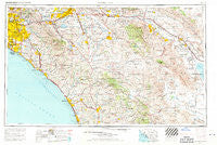
~ Santa Ana CA topo map, 1:250000 scale, 1 X 2 Degree, Historical, 1959, updated 1971
Santa Ana, California, USGS topographic map dated 1959.
Includes geographic coordinates (latitude and longitude). This topographic map is suitable for hiking, camping, and exploring, or framing it as a wall map.
Printed on-demand using high resolution imagery, on heavy weight and acid free paper, or alternatively on a variety of synthetic materials.
Topos available on paper, Waterproof, Poly, or Tyvek. Usually shipping rolled, unless combined with other folded maps in one order.
- Product Number: USGS-5506719
- Free digital map download (high-resolution, GeoPDF): Santa Ana, California (file size: 21 MB)
- Map Size: please refer to the dimensions of the GeoPDF map above
- Weight (paper map): ca. 55 grams
- Map Type: POD USGS Topographic Map
- Map Series: HTMC
- Map Verison: Historical
- Cell ID: 69016
- Scan ID: 302141
- Imprint Year: 1971
- Woodland Tint: Yes
- Aerial Photo Year: 1955
- Edit Year: 1969
- Field Check Year: 1959
- Datum: Unstated
- Map Projection: Transverse Mercator
- Map published by: Military, Other
- Map Language: English
- Scanner Resolution: 600 dpi
- Map Cell Name: Santa Ana
- Grid size: 1 X 2 Degree
- Date on map: 1959
- Map Scale: 1:250000
- Geographical region: California, United States
Neighboring Maps:
All neighboring USGS topo maps are available for sale online at a variety of scales.
Spatial coverage:
Topo map Santa Ana, California, covers the geographical area associated the following places:
- De Luz - Placentia - Carlton - Thousand Palms - Bonnie Bell - South Laguna - Olivenhain - Villa Park - Santa Margarita Groves - Vista Verde Estates Mobile Home Park - Cowan Heights - Encinitas - Pala Mesa - Modjeska - Sylvan Meadows - Brookfield Manor Mobile Home Park - Los Tules - Lake Forest - Lakeland Village - Micaflores - Fernwood Mobile Home Park - Tustin Village Mobile Home Club - Foothills of San Marcos Mobile Home Park - Santa Ysabel - Moreno - Carbondale (historical) - Huntington Mobile Home Estates - Eden Hot Springs - Golden Skies Mobile Home Park - Valle Vista - Balboa Island - Santa Rosa Ranch Estates - Palm Lodge Mobile Home Estates - Riviera Mobile Home Park - Del Cerro Mobile Home Estates - Sun City - Orange Park Acres - Escondido Junction - California Mobile Home Park - Daum (historical) - Beeks Place - Rancho Bernardo - Winterwarm - Capistrano Beach - Laguna Vista Trailer Park - Sleepy Hollow - El Nido Mobile Home Estates (historical) - Mons - Casa Blanca - Casa Loma - Balboa - Elfin Forest - Cathedral City - Santa Rosa West - Rosemont - Stanton - Lake Village - Romoland - East La Mirada - San Onofre - DeLuz - Hewes Park - Capistrano Valley Mobile Home Estates - Murrieta Hot Springs - Beaumont - Fullerton - Boys Republic - Fountain Valley - Coolidge Springs - Rancho Trabuco - Katella Mobile Home Estates - Menifee Lakes - Mesa Grande - Moreno Valley - Valerie - Los Serranos - Harrison Park - Royal Palms - Creekside Mobile Home Estates - Prado Verde Mobile Home Park - Almond - Ivy del Mobile Home Park - Cabazon - Nicklin - El Toro - Suntown - Play Port Mobile Home Village - Santa Rosa South - Rancho del Avion Capistrano Mobile Home Park - Mecca - Pushawalla Palms - Lake Elsinore - Greencrest Park Mobile Home Park - Coachella - Ballena - Serrano Heights - Carlsbad Trailer Park - Bolsa - Anaheim Shores - Ponderosa Mobile Home Estates
- Map Area ID: AREA3433-118-116
- Northwest corner Lat/Long code: USGSNW34-118
- Northeast corner Lat/Long code: USGSNE34-116
- Southwest corner Lat/Long code: USGSSW33-118
- Southeast corner Lat/Long code: USGSSE33-116
- Northern map edge Latitude: 34
- Southern map edge Latitude: 33
- Western map edge Longitude: -118
- Eastern map edge Longitude: -116


