
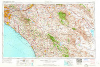
~ Santa Ana CA topo map, 1:250000 scale, 1 X 2 Degree, Historical, 1965, updated 1965
Santa Ana, California, USGS topographic map dated 1965.
Includes geographic coordinates (latitude and longitude). This topographic map is suitable for hiking, camping, and exploring, or framing it as a wall map.
Printed on-demand using high resolution imagery, on heavy weight and acid free paper, or alternatively on a variety of synthetic materials.
Topos available on paper, Waterproof, Poly, or Tyvek. Usually shipping rolled, unless combined with other folded maps in one order.
- Product Number: USGS-5506717
- Free digital map download (high-resolution, GeoPDF): Santa Ana, California (file size: 22 MB)
- Map Size: please refer to the dimensions of the GeoPDF map above
- Weight (paper map): ca. 55 grams
- Map Type: POD USGS Topographic Map
- Map Series: HTMC
- Map Verison: Historical
- Cell ID: 69016
- Scan ID: 302140
- Imprint Year: 1965
- Woodland Tint: Yes
- Field Check Year: 1959
- Datum: Unstated
- Map Projection: Transverse Mercator
- Map published by United States Army Corps of Engineers
- Map published by United States Army
- Map Language: English
- Scanner Resolution: 600 dpi
- Map Cell Name: Santa Ana
- Grid size: 1 X 2 Degree
- Date on map: 1965
- Map Scale: 1:250000
- Geographical region: California, United States
Neighboring Maps:
All neighboring USGS topo maps are available for sale online at a variety of scales.
Spatial coverage:
Topo map Santa Ana, California, covers the geographical area associated the following places:
- Eastvale - Rancho Fullerton Mobile Home Estates - Cahuilla Hills - Heritage Mobile Home Park - Holcomb Village - Royal Gardens Mobile Home Estates - El Camino 76 Trailer Park - Kentwood-In-The-Pines - Perris - Bermuda Palms Mobile Park - Anaheim Shores - Lake Park Santa Ana - Fairview Mobile Home Estates - Montesilla Mobile Home Club - Fern Valley - Friendly Village of Anaheim - Edom - Imperial Escondido Estates Mobile Home Park - Rancho Vista Mobile Home Park - Borrego Springs - Midway City - Pala - Newport Coast - Ivy del Mobile Home Park - Mission Viejo - Los Serranos - Escondido - La Bolsa - Lake Forest - La Paloma - Moonlight Rim - Casa Blanca - Marlboro - Gilman Hot Springs - Casa de Amigos Mobile Home Park - Shadow Ridge Creek - Hoosier Trailer Court - Casitas del Sol Mobile Home Park - Serrano Place - Anaheim - East La Mirada - Dorado Mobile Home Park - Eden - Fountain Valley Mobile Home Estates - Lake San Marcos - Rancho Bernardo - Sunnymead - Desert Groves Mobile Home Park - El Nido Mobile Home Estates (historical) - Rancho Casitas Mobile Home Park - Taggin Wagon Mobile Home Park - Coach Royal Trailer Park - Moreno Knolls - Foothill Ranch - Mons - Dove Canyon - Liberty Mobile Home Court - Snug Harbor Trailer Park (historical) - Wintersburg - Kathryn - Beach West Mobile Home Estates - Palomar Park Mobile Home Park - Sun City - Santa Rosa South - Garden Grove - Rowland Heights - Linda Rose - California Mobile Home Park - Leucadia - Laguna Hills - Carefree Ranch Mobile Home Park - Highland Plams Mobile Home Park - Homeland - Emerald Isle Mobile Home Park - Ponderosa Mobile Home Park - Miraflores (historical) - Nuevo - Carlsbad - San Juan Mobile Home Estates - Gavilan Hills - Val Verde - Oak Grove - Arnold Heights - Snow Creek - Arlington - Como - Vista Verde Estates Mobile Home Park - Temecula Ranchos - Rancho La Paz - Trabuco Canyon - Green Lantern Village - Moreno - Silver Spur Mobile Manor - Ribbonwood - Villa Huntington Mobile Home Park - Garnet - Vista Santa Rosa - La Belle Fontane Estates - White Water - Daum (historical)
- Map Area ID: AREA3433-118-116
- Northwest corner Lat/Long code: USGSNW34-118
- Northeast corner Lat/Long code: USGSNE34-116
- Southwest corner Lat/Long code: USGSSW33-118
- Southeast corner Lat/Long code: USGSSE33-116
- Northern map edge Latitude: 34
- Southern map edge Latitude: 33
- Western map edge Longitude: -118
- Eastern map edge Longitude: -116


