
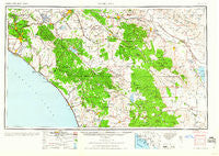
~ Santa Ana CA topo map, 1:250000 scale, 1 X 2 Degree, Historical, 1960, updated 1960
Santa Ana, California, USGS topographic map dated 1960.
Includes geographic coordinates (latitude and longitude). This topographic map is suitable for hiking, camping, and exploring, or framing it as a wall map.
Printed on-demand using high resolution imagery, on heavy weight and acid free paper, or alternatively on a variety of synthetic materials.
Topos available on paper, Waterproof, Poly, or Tyvek. Usually shipping rolled, unless combined with other folded maps in one order.
- Product Number: USGS-5506715
- Free digital map download (high-resolution, GeoPDF): Santa Ana, California (file size: 16 MB)
- Map Size: please refer to the dimensions of the GeoPDF map above
- Weight (paper map): ca. 55 grams
- Map Type: POD USGS Topographic Map
- Map Series: HTMC
- Map Verison: Historical
- Cell ID: 69016
- Scan ID: 302139
- Imprint Year: 1960
- Woodland Tint: Yes
- Aerial Photo Year: 1944
- Datum: NAD27
- Map Projection: Transverse Mercator
- Map published by United States Army Corps of Engineers
- Map published by United States Army
- Map Language: English
- Scanner Resolution: 600 dpi
- Map Cell Name: Santa Ana
- Grid size: 1 X 2 Degree
- Date on map: 1960
- Map Scale: 1:250000
- Geographical region: California, United States
Neighboring Maps:
All neighboring USGS topo maps are available for sale online at a variety of scales.
Spatial coverage:
Topo map Santa Ana, California, covers the geographical area associated the following places:
- South Anaheim - Del Cerro Mobile Home Estates - Capistrano Beach - Regal Mobile Club Estates - Gardners Trailer Park - Ponderosa Club Mobile Home Park - Fallbrook - Don (historical) - Moreno - Biskra Palms - Escondido Junction - Neff - Brookhurst - Terra Cotta - Balboa - Agra - Calimesa Mobile Home Ranch - Mira Loma - Oceana - Vista Cascade Mobile Home Park - Mobile Haven Mobile Home Park - Belvedere Heights - Santa Rosa South - Sage - Town and Country Villa - Pine Wood - Thurin - Jofegan - Parque Pacifico Mobile Home Park - Rancho Vista Mobile Home Park - Woodcrest - Garnet - Tustin Village Mobile Home Club - Rancho Escondido Mobile Home Park - Val Verde - Winchester - Silver Spur Mobile Manor - Santa Ana - Indian Oaks - Palomar Mountain - Edom - Westminster Mobile Home Park - Bit-O-Home Trailer Park - Lake Elsinore - Pedley - Tradewinds Trailer Village - Yorba Linda - La Sierra Heights - Sylvan Meadows - Imperial Escondido Estates Mobile Home Park - Creekside Mobile Home Estates - Linda Rose - Cabazon - Orange Village Mobile Home Park - Caliente Sands - Encinitas - San Marcos Mobile Estates - Quail Valley - Orange Park Acres - Colonia Juarez - Cannery Village Mobile Home Park - Trabuco Highlands - Harrison Park - Ramona Bowl - Willowick Royal Mobile Home Park - Daum (historical) - Scissors Crossing - Goforth Mobile Home Village - Casa Hermosa Mobile Home Park - Laguna Terace Mobile Home Park - Taylor - May - Pala Mesa - Elfin Forest - Gavilan Hills - Lemona - Indio - The Views Mobile Home Park - Silverado - Highland Springs - Sleepy Hollow - Rancho Huntington Mobile Home Park - Brea Chem - Galivan - Modjeska - Rimlon - Peralta Hills - Bahia Trailer Villa - Saddleback Mobile Lodge - Mobile Park West Mobile Home Park - Ocean Hills - Sunkist Gardens - Leffingwell - Dana Point - Sky Valley - Oak Haven Estates - Bermuda Palms Mobile Park - Suntown - Radec - Sierra Vista Trailer Park
- Map Area ID: AREA3433-118-116
- Northwest corner Lat/Long code: USGSNW34-118
- Northeast corner Lat/Long code: USGSNE34-116
- Southwest corner Lat/Long code: USGSSW33-118
- Southeast corner Lat/Long code: USGSSE33-116
- Northern map edge Latitude: 34
- Southern map edge Latitude: 33
- Western map edge Longitude: -118
- Eastern map edge Longitude: -116


