
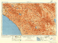
~ Santa Ana CA topo map, 1:250000 scale, 1 X 2 Degree, Historical, 1956, updated 1956
Santa Ana, California, USGS topographic map dated 1956.
Includes geographic coordinates (latitude and longitude). This topographic map is suitable for hiking, camping, and exploring, or framing it as a wall map.
Printed on-demand using high resolution imagery, on heavy weight and acid free paper, or alternatively on a variety of synthetic materials.
Topos available on paper, Waterproof, Poly, or Tyvek. Usually shipping rolled, unless combined with other folded maps in one order.
- Product Number: USGS-5506713
- Free digital map download (high-resolution, GeoPDF): Santa Ana, California (file size: 21 MB)
- Map Size: please refer to the dimensions of the GeoPDF map above
- Weight (paper map): ca. 55 grams
- Map Type: POD USGS Topographic Map
- Map Series: HTMC
- Map Verison: Historical
- Cell ID: 69016
- Scan ID: 302138
- Imprint Year: 1956
- Aerial Photo Year: 1944
- Datum: NAD27
- Map Projection: Transverse Mercator
- Shaded Relief map: Yes
- Map published by United States Army Corps of Engineers
- Map published by United States Army
- Map Language: English
- Scanner Resolution: 600 dpi
- Map Cell Name: Santa Ana
- Grid size: 1 X 2 Degree
- Date on map: 1956
- Map Scale: 1:250000
- Geographical region: California, United States
Neighboring Maps:
All neighboring USGS topo maps are available for sale online at a variety of scales.
Spatial coverage:
Topo map Santa Ana, California, covers the geographical area associated the following places:
- Villa Valencia - Martinez - Dyer - Rancho Vista Mobile Home Park - Westwinds Lodge Mobile Home Park - Rancho San Luis Rey Trailer Park - Murrieta - Des Moines - Oceanside - Plaza Mobile Home Estates - The Views Mobile Home Park - Dorado Mobile Home Park - Glen Valley - Laguna Woods - Hidden Vale Mobile Home Park - Arnold Heights - Santa Rosa South - Yorba Linda - Americana Mobile Home Park - Vista Verde Estates Mobile Home Park - Villa Grande Mobile Home Park - Ivy del Mobile Home Park - Portola Hills - Rancho Thirty-nine Mobile Home Park - Como - Hacienda Heights - Creekside Mobile Home Estates - Los Alamitos Junction - San Juan Mobile Home Estates - Canyon Lake - Prenda - Olivenhain - Pueblo del Sol Mobile Park - Suntown - El Modena - Lawrence Welk Resort Village - Corona del Mar - Gold Star Mobile Home - Taggin Wagon Mobile Home Park - Windsor Crest - Oak Grove - Island View Trailer Park - Jesmond Dene - San Diego Country Estates - Green Valley Mobile Home Park - Gardners Trailer Park - Micaflores - The Palms Trailer Park - Rancho Santa Fe - Indio - Eastvale - San Onofre - Bahia Trailer Villa - Bolsa Verde - Laguna Hills Mobile Home Estates - San Clemente - Hidden Meadows - Peralta Hills - Casa de Amigos Mobile Home Park - Kona Kai Mobile Home Park - Sedco Hills - Taylor - Colina Vista - Galivan - Rancho Fullerton Mobile Home Estates - Daum (historical) - Santa Ysabel (historical) - Rancho las Perris - Laguna Beach - Pachappa - Lemon Heights - Sunkist Gardens - Sugar (historical) - Newport Marina Mobile Home Park - El Nido Mobile Home Estates - Indian Wells - Serrano Place - Sleepy Hollow - Harmony Grove - Thurin - Lake San Marcos - Sunnyside Estates - Arlington Station - Seacliffe Mobile Home Park - Ellis - Macomber Palms - South Anaheim - Anaheim Mobile Home Estates - San Juan Hot Springs - Rainbow Canyon Village - Alessandro - Thomas Mountain - Fountain Valley Mobile Home Estates - Midway City - Hemet - Casitas del Sol Mobile Home Park - Carlsbad - Del Cerro Mobile Home Estates - Aguanga - Buena Park
- Map Area ID: AREA3433-118-116
- Northwest corner Lat/Long code: USGSNW34-118
- Northeast corner Lat/Long code: USGSNE34-116
- Southwest corner Lat/Long code: USGSSW33-118
- Southeast corner Lat/Long code: USGSSE33-116
- Northern map edge Latitude: 34
- Southern map edge Latitude: 33
- Western map edge Longitude: -118
- Eastern map edge Longitude: -116


