
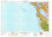
~ San Francisco CA topo map, 1:250000 scale, 1 X 2 Degree, Historical, 1964, updated 1964
San Francisco, California, USGS topographic map dated 1964.
Includes geographic coordinates (latitude and longitude). This topographic map is suitable for hiking, camping, and exploring, or framing it as a wall map.
Printed on-demand using high resolution imagery, on heavy weight and acid free paper, or alternatively on a variety of synthetic materials.
Topos available on paper, Waterproof, Poly, or Tyvek. Usually shipping rolled, unless combined with other folded maps in one order.
- Product Number: USGS-5506669
- Free digital map download (high-resolution, GeoPDF): San Francisco, California (file size: 12 MB)
- Map Size: please refer to the dimensions of the GeoPDF map above
- Weight (paper map): ca. 55 grams
- Map Type: POD USGS Topographic Map
- Map Series: HTMC
- Map Verison: Historical
- Cell ID: 69014
- Scan ID: 302117
- Imprint Year: 1964
- Woodland Tint: Yes
- Field Check Year: 1956
- Datum: Unstated
- Map Projection: Transverse Mercator
- Map published by United States Army Corps of Engineers
- Map published by United States Army
- Map Language: English
- Scanner Resolution: 600 dpi
- Map Cell Name: San Francisco
- Grid size: 1 X 2 Degree
- Date on map: 1964
- Map Scale: 1:250000
- Geographical region: California, United States
Neighboring Maps:
All neighboring USGS topo maps are available for sale online at a variety of scales.
Spatial coverage:
Topo map San Francisco, California, covers the geographical area associated the following places:
- Clinton (historical) - Monroe Park - Ingleside Terrace - East Richmond - Sausalito - Paradise Cay - Palo Verde - Golden Gate Heights - Linfield Oaks - Camp Evers - Emerald Lake - Brisbane - Sahara Village Mobile Home Park - Red Arrow Mobile Home Park - Boulder Creek - Saint Francis Acres - Stege - Spanish Ranch Mobile Home Park - Dimond District - El Dorado Mobile Home Park - Treasure Island Mobile Home Park - Palo Alto - Pierce Mitchell Houses - Fort Winfield Scott - Rancho la Mesa Mobile Home Court - Trailer Rancho Mobile Home Park - Stanford - Bayshore - Cape Cod Village Mobile Home Park - Laurel - San Pedro Terrace - North Fair Oaks - Western Addition - Redwood Park - The Willows - Lorenzo Station - Glenridge - Champagne Fountain - Belvedere - Hookston - Lobitos - Loyola Corners - Felton - Bracken Brae - Mayfield - Hayward Park - Glen Arbor - Presidio Terrace - Vista Del Monte - Russell City - Burlingame - Bayside Village - Marcus Garvey Square - Alto - Fernside - Opera Plaza - San Leandro - Runnymeade (historical) - Cupertino - Half Moon Bay - Chapman - Aloha Mobile Village - Rancho Rinconada - Muir Beach - Alameda - Mowry Landing - Homestead Valley - North Beach - Thomas Paine Square - Evergreen Park - Laurel - Almonte - Harbor Village Mobile Home Park - Bellvale - Lompico - Canyon - Nystrom Village - Woodside Glens - West Portal - Bel Aire - Fairoaks Mobile Home Park - Baumberg - Miramar - Adobe Meadow - Havenscourt - Dearborn Park - Andry Mobile Home Park - Ladera - Rockaway Beach - Rheem - Halvern - Fair Oaks - Merced Manor - Little Reed Heights - Martin Luther King Square - Saint Francis - Emeryville - Saint Francis Square - Murray Park - The Highlands
- Map Area ID: AREA3837-124-122
- Northwest corner Lat/Long code: USGSNW38-124
- Northeast corner Lat/Long code: USGSNE38-122
- Southwest corner Lat/Long code: USGSSW37-124
- Southeast corner Lat/Long code: USGSSE37-122
- Northern map edge Latitude: 38
- Southern map edge Latitude: 37
- Western map edge Longitude: -124
- Eastern map edge Longitude: -122


