
~ San Francisco CA topo map, 1:250000 scale, 1 X 2 Degree, Historical, 1960, updated 1960
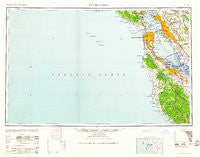
San Francisco, California, USGS topographic map dated 1960.
Includes geographic coordinates (latitude and longitude). This topographic map is suitable for hiking, camping, and exploring, or framing it as a wall map.
Printed on-demand using high resolution imagery, on heavy weight and acid free paper, or alternatively on a variety of synthetic materials.
Topos available on paper, Waterproof, Poly, or Tyvek. Usually shipping rolled, unless combined with other folded maps in one order.
- Product Number: USGS-5506665
- Free digital map download (high-resolution, GeoPDF): San Francisco, California (file size: 11 MB)
- Map Size: please refer to the dimensions of the GeoPDF map above
- Weight (paper map): ca. 55 grams
- Map Type: POD USGS Topographic Map
- Map Series: HTMC
- Map Verison: Historical
- Cell ID: 69014
- Scan ID: 302115
- Imprint Year: 1960
- Woodland Tint: Yes
- Aerial Photo Year: 1945
- Datum: Unstated
- Map Projection: Transverse Mercator
- Map published by United States Army Corps of Engineers
- Map published by United States Army
- Map Language: English
- Scanner Resolution: 600 dpi
- Map Cell Name: San Francisco
- Grid size: 1 X 2 Degree
- Date on map: 1960
- Map Scale: 1:250000
- Geographical region: California, United States
Neighboring Maps:
All neighboring USGS topo maps are available for sale online at a variety of scales.
Spatial coverage:
Topo map San Francisco, California, covers the geographical area associated the following places:
- Point Richmond - Fairoaks Mobile Home Park - Tiburon - Bracken Brae - Broadmoor Village - Lloyden Park - Cragmont - Campbell Village - Los Ranchitos - Blossom Valley - Nystrom Village - Runnymeade (historical) - Cragmont - Laguna Heights - Martins Beach - El Campo - McNears Beach - Oceanview - Halvern - The Highlands - Tamalpais Valley - San Pablo - Jackson Park - Escondido Village - Fernside - Swanton - Corte Madera - Marina District - Sunnyvale - Palomar Park - Fort Winfield Scott - Riverside Grove - Edgemar - Los Altos - Saratoga - Canada Home Mobile Home Park - Redwood Park - Woodside Highlands - Sunset District - Canyon - Lomita Park - Victoria Mews - Meadowsweet - Harbor Village Mobile Home Park - Woodville - Saint Francis Square - Saranap - University Heights - Trailer Rancho Mobile Home Park - Westridge - Eastport - Zayante - Belvedere - Pacheco - San Mateo Park - Rancho Rinconada - Henderson - Jordan Park - Professorville - Hillsborough - Glen Frazer - Cupertino - Richmond District - Mowry Landing - Bellvale - Los Altos Hills - Newark - West Berkeley - Mission District - Paradise Park - Woodside - Sylvan Park - Fairview - Southgate - Rheem - East Palo Alto - University Village - Saint Francis Acres - Piedmont - Ingleside Heights - Redwood Shores - Palo Alto - San Anselmo - Woodside Glens - Menlo Park - Village Square - Bayshore - Glenridge - Sahara Village Mobile Home Park - Cooley Landing - Castro Valley - Farm Hills - Atherton - Le Mar Mobile Home Park - Gemello - Felton Gables - Mulford Gardens - Dearborn Park - Brookdale - Leona Heights
- Map Area ID: AREA3837-124-122
- Northwest corner Lat/Long code: USGSNW38-124
- Northeast corner Lat/Long code: USGSNE38-122
- Southwest corner Lat/Long code: USGSSW37-124
- Southeast corner Lat/Long code: USGSSE37-122
- Northern map edge Latitude: 38
- Southern map edge Latitude: 37
- Western map edge Longitude: -124
- Eastern map edge Longitude: -122


