
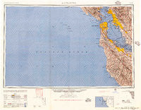
~ San Francisco CA topo map, 1:250000 scale, 1 X 2 Degree, Historical, 1957, updated 1957
San Francisco, California, USGS topographic map dated 1957.
Includes geographic coordinates (latitude and longitude). This topographic map is suitable for hiking, camping, and exploring, or framing it as a wall map.
Printed on-demand using high resolution imagery, on heavy weight and acid free paper, or alternatively on a variety of synthetic materials.
Topos available on paper, Waterproof, Poly, or Tyvek. Usually shipping rolled, unless combined with other folded maps in one order.
- Product Number: USGS-5506663
- Free digital map download (high-resolution, GeoPDF): San Francisco, California (file size: 31 MB)
- Map Size: please refer to the dimensions of the GeoPDF map above
- Weight (paper map): ca. 55 grams
- Map Type: POD USGS Topographic Map
- Map Series: HTMC
- Map Verison: Historical
- Cell ID: 69014
- Scan ID: 302114
- Imprint Year: 1957
- Aerial Photo Year: 1945
- Datum: Unstated
- Map Projection: Transverse Mercator
- Map published by United States Army Corps of Engineers
- Map published by United States Army
- Map Language: English
- Scanner Resolution: 600 dpi
- Map Cell Name: San Francisco
- Grid size: 1 X 2 Degree
- Date on map: 1957
- Map Scale: 1:250000
- Geographical region: California, United States
Neighboring Maps:
All neighboring USGS topo maps are available for sale online at a variety of scales.
Spatial coverage:
Topo map San Francisco, California, covers the geographical area associated the following places:
- Vallemar - San Rafael - Muir Beach - Moffett Trailer Village - Davenport Landing - Saint Francis Wood - Millbrae - Atchison Village - Gold Mine Hill - Ventura - Vintage Oaks - Garcia Avenue Mobile Home Park - Lindenwood - Hillsborough Park - Little Italy - East Richmond Heights - Redwood Grove - Redwood Terrace - Eastmont - San Carlos - Evergreen Park - Rollingwood - Linfield Oaks - San Francisco - San Anselmo - Homestead Valley - Pabrico - Alameda - Richmond District - Newark - Merced Heights - Reed - University Village - Franciscan Mobile Home Park - Forest Park - Glen Frazer - Eldton - Stanford Weekend Acres - Canyon - Woodside - Robert (historical) - Highland Park - Sky Londa - Los Altos Hills - Eastport - Woodside Highlands - Alamo - Forest Hill - Plaza del Rey Mobile Home Park - Crocker Highlands - Mill Valley - Ashland - Menlo Oaks - Martin Luther King Square - Brookfield Village - Meadow Park - Triangle Court - Chinatown - Harbor Village Mobile Home Park - Atherton - Sausalito - Point Richmond - Marcus Garvey Square - San Quentin - Westridge - Santiago Villa Mobile Home Park - Ingleside - Bancroft - Mowry Landing - Saranap - San Mateo - Redwood City Mobile Home Park - Mulford Gardens - Saint Francis Acres - Fernside - North Point Public Housing - Highlands - Larkspur - Mary Manor Mobile Estates - Dearborn Park - Menlo Oaks - Ingleside Heights - Oakland - Union City - Sharon Heights - Glen Arbor - Moraga - The Highlands - Spanish Ranch Mobile Home Park - College Terrace - Waldo - Adobe Meadow - Fort Winfield Scott - Manzanita - Continental Mobile Home Park - Ranchero Thunderbird Mobile Home Court - Palo Alto Orchards - Waldon - Belvedere - San Pedro Terrace
- Map Area ID: AREA3837-124-122
- Northwest corner Lat/Long code: USGSNW38-124
- Northeast corner Lat/Long code: USGSNE38-122
- Southwest corner Lat/Long code: USGSSW37-124
- Southeast corner Lat/Long code: USGSSE37-122
- Northern map edge Latitude: 38
- Southern map edge Latitude: 37
- Western map edge Longitude: -124
- Eastern map edge Longitude: -122


