
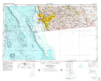
~ San Diego CA topo map, 1:250000 scale, 1 X 2 Degree, Historical, 1958, updated 1979
San Diego, California, USGS topographic map dated 1958.
Includes geographic coordinates (latitude and longitude). This topographic map is suitable for hiking, camping, and exploring, or framing it as a wall map.
Printed on-demand using high resolution imagery, on heavy weight and acid free paper, or alternatively on a variety of synthetic materials.
Topos available on paper, Waterproof, Poly, or Tyvek. Usually shipping rolled, unless combined with other folded maps in one order.
- Product Number: USGS-5506661
- Free digital map download (high-resolution, GeoPDF): San Diego, California (file size: 19 MB)
- Map Size: please refer to the dimensions of the GeoPDF map above
- Weight (paper map): ca. 55 grams
- Map Type: POD USGS Topographic Map
- Map Series: HTMC
- Map Verison: Historical
- Cell ID: 69013
- Scan ID: 299882
- Imprint Year: 1979
- Woodland Tint: Yes
- Aerial Photo Year: 1955
- Edit Year: 1978
- Field Check Year: 1958
- Datum: Unstated
- Map Projection: Transverse Mercator
- Map published by United States Geological Survey
- Map published by United States Department of Commerce
- Map Language: English
- Scanner Resolution: 600 dpi
- Map Cell Name: San Diego
- Grid size: 1 X 2 Degree
- Date on map: 1958
- Map Scale: 1:250000
- Geographical region: California, United States
Neighboring Maps:
All neighboring USGS topo maps are available for sale online at a variety of scales.
Spatial coverage:
Topo map San Diego, California, covers the geographical area associated the following places:
- Descanso Junction - Guatay - South Park - Pine Grove - Harbison Canyon - Ladrillo (historical) - North Jamul - Mountain View - College Heights - Linda Vista (historical) - La Presa - Old Town San Diego - Los Terrenitos - Tierrasanta - East San Diego - Riviera Shores - University City - Sunset Cliffs - Otay Mesa - Bay Park - San Ysidro - La Playa - Clairemont - Barona - North Bay Terraces - Mussey Grove (historical) - Chollas Creek - Boulder Park - Logan Heights - Poway Royal Mobile Estates - Casa de Oro - Tent City (historical) - Lomita - Village Green Trailer Park - Engineer Springs - Potrero - Boal - La Jolla Shores - Flinn Springs - Rock Haven (historical) - Lakeview - Stockton - Hacienda del Florasol - Valencia Park - Lemon Grove - Cameron Corners - Alpine Heights - Del Mar - Sunnyside - Glenview - Fruitdale - Tierra del Sol - Eastlake - Shady Dell - Hillcrest - Lincoln Park - Shelltown - National City - Sabre Springs - Mira Mesa - Mission Hills - Morena - Live Oak Springs - Pleasant Valley Mobile Home Park - Golden Hill - Nestor - Blossom Valley - San Diego - Calexico Lodge - Rancho Del Campo - Mount Laguna - Mission Gorge Villa Mobile Home Park - North Clairemont - Bancroft Point - Eucalyptus Hills - Pacific Beach - Dos Cabezas - Grantville - Santee - Easter Cross - Calavo Gardens - Poway - La Jolla Hermosa - Sunny Vista - South Bay Terraces - Encanto - South San Diego - Mission del Magnolia Mobile Home Park - Loma Portal - Indian Springs - Imperial Beach - Granite Hills - Riverview - La Jolla - South Encantato - Dulzura - Clover Flat - Hawaiian Village Mobile Home Park - Roseville - Meadowbrook Mobile Home Park
- Map Area ID: AREA3332-118-116
- Northwest corner Lat/Long code: USGSNW33-118
- Northeast corner Lat/Long code: USGSNE33-116
- Southwest corner Lat/Long code: USGSSW32-118
- Southeast corner Lat/Long code: USGSSE32-116
- Northern map edge Latitude: 33
- Southern map edge Latitude: 32
- Western map edge Longitude: -118
- Eastern map edge Longitude: -116


