
~ San Diego CA topo map, 1:250000 scale, 1 X 2 Degree, Historical, 1958, updated 1973
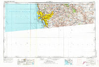
San Diego, California, USGS topographic map dated 1958.
Includes geographic coordinates (latitude and longitude). This topographic map is suitable for hiking, camping, and exploring, or framing it as a wall map.
Printed on-demand using high resolution imagery, on heavy weight and acid free paper, or alternatively on a variety of synthetic materials.
Topos available on paper, Waterproof, Poly, or Tyvek. Usually shipping rolled, unless combined with other folded maps in one order.
- Product Number: USGS-5506659
- Free digital map download (high-resolution, GeoPDF): San Diego, California (file size: 16 MB)
- Map Size: please refer to the dimensions of the GeoPDF map above
- Weight (paper map): ca. 55 grams
- Map Type: POD USGS Topographic Map
- Map Series: HTMC
- Map Verison: Historical
- Cell ID: 69013
- Scan ID: 299881
- Imprint Year: 1973
- Woodland Tint: Yes
- Aerial Photo Year: 1955
- Edit Year: 1970
- Field Check Year: 1958
- Datum: Unstated
- Map Projection: Transverse Mercator
- Map published by: Military, Other
- Map Language: English
- Scanner Resolution: 600 dpi
- Map Cell Name: San Diego
- Grid size: 1 X 2 Degree
- Date on map: 1958
- Map Scale: 1:250000
- Geographical region: California, United States
Neighboring Maps:
All neighboring USGS topo maps are available for sale online at a variety of scales.
Spatial coverage:
Topo map San Diego, California, covers the geographical area associated the following places:
- Nestor - Elvira - Hulburd Grove - Sunny Vista - Mussey Grove (historical) - Palm City - Bayside Village - Canyon City - Jacumba Hot Springs - Bostonia - The Muirlands - Fernbrook - Grantville - Eden Gardens - Tierra del Sol - The Woods Trailer Park - Campo - Fiesta Shores - Clover Flat - Greenbrier Mobile Home Park - Paradise Hills - Bonita - Shady Dell - Palm Grove - Hawaiian Village Mobile Home Park - Calexico Lodge - Cockatoo Grove - Cajon Heights - Imperial Beach - Dos Cabezas - Mount Helix - Jamul Indian Village - South Bay Terraces - Sabre Springs - North Park - Poway Grove Park - Pleasant Valley Mobile Home Park - Johnstown - De Anza Trailer Harbor - La Cresta - Boulder Park - Mortero Palms - Roseville - Barrett Junction - La Mesa - Mission Beach - Azure Vista - Fleetridge - Haleys Trailer Ranch - Live Oak Springs - Morena Village - Tent City (historical) - Serra Mesa - Laguna Junction - Golden Hill - Valencia Park - Boulder Oaks - Lynwood Hills - Lakeview - Eastlake Greens - Easter Cross - Barona - Lincoln Acres - Alta (historical) - Mount Laguna - Morena - Stallion Oaks - Stockton - Descanso - La Playa - Del Cerro - Rancho del Rey - Overlook - Mount Hope - Coronado - Guatay - Bay Park - Foster - South Crest - South San Diego - Rancho Penasquitos - Glenview - Moreno - Mission del Magnolia Mobile Home Park - Shelltown - Jamacha Junction - Pine Grove - Encanto - Mission Hills - Titus - La Jolla Shores - Pine Valley - Lincoln Park - Doghouse Junction - Eastlake - Rancho Del Campo - Irvings Crest - Harbor Side - Alpine - Lomita
- Map Area ID: AREA3332-118-116
- Northwest corner Lat/Long code: USGSNW33-118
- Northeast corner Lat/Long code: USGSNE33-116
- Southwest corner Lat/Long code: USGSSW32-118
- Southeast corner Lat/Long code: USGSSE32-116
- Northern map edge Latitude: 33
- Southern map edge Latitude: 32
- Western map edge Longitude: -118
- Eastern map edge Longitude: -116


