
~ San Diego CA topo map, 1:250000 scale, 1 X 2 Degree, Historical, 1958, updated 1965
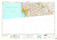
San Diego, California, USGS topographic map dated 1958.
Includes geographic coordinates (latitude and longitude). This topographic map is suitable for hiking, camping, and exploring, or framing it as a wall map.
Printed on-demand using high resolution imagery, on heavy weight and acid free paper, or alternatively on a variety of synthetic materials.
Topos available on paper, Waterproof, Poly, or Tyvek. Usually shipping rolled, unless combined with other folded maps in one order.
- Product Number: USGS-5506657
- Free digital map download (high-resolution, GeoPDF): San Diego, California (file size: 11 MB)
- Map Size: please refer to the dimensions of the GeoPDF map above
- Weight (paper map): ca. 55 grams
- Map Type: POD USGS Topographic Map
- Map Series: HTMC
- Map Verison: Historical
- Cell ID: 69013
- Scan ID: 299880
- Imprint Year: 1965
- Woodland Tint: Yes
- Edit Year: 1964
- Field Check Year: 1958
- Datum: Unstated
- Map Projection: Transverse Mercator
- Map published by United States Geological Survey
- Map published by United States Army Corps of Engineers
- Map published by United States Army
- Map Language: English
- Scanner Resolution: 600 dpi
- Map Cell Name: San Diego
- Grid size: 1 X 2 Degree
- Date on map: 1958
- Map Scale: 1:250000
- Geographical region: California, United States
Neighboring Maps:
All neighboring USGS topo maps are available for sale online at a variety of scales.
Spatial coverage:
Topo map San Diego, California, covers the geographical area associated the following places:
- Linda Vista - Bonita - Stallion Oaks - Guatay - Laguna Junction - Meadowbrook Mobile Home Park - Rancho San Diego - Lakeview - Azure Vista - La Mesa - Highlands Mobile Home Park - Rancho Del Campo - El Cajon - Haleys Trailer Ranch - Mission Hills - University City - Morena - Mission Beach - Homelands - Roseville - Irvings Crest - Coronado - Loma Portal - Alta (historical) - University Heights - Miramar - Overlook - Boulder Park - Palm City - Boulder Oaks - Lemon Grove - Tent City (historical) - Indian Springs - Suncrest - Hillcrest - Morena Village - Cockatoo Grove - Riverview Farms - The Willows - East San Diego - Valencia Park - Fort Rosecrans - Dulzura - Santee - Cuyamaca (historical) - Chollas View - Eden Gardens - South Park - San Diego - College Heights - Grant Hill - Lakeside - Jamul - The Woods Trailer Park - Phelps Corner - Alpine - Live Oak Springs - Rock Haven (historical) - Lincoln Park - Bayside Village - Allied Gardens - Easter Cross - Scripps Ranch - Clairemont - Barrio Logan - North Bay Terraces - Crest - Cajon Heights - Grantville - Ladrillo (historical) - Mission del Magnolia Mobile Home Park - Lincoln Acres - Ocean Beach - Hawaiian Village Mobile Home Park - Bay Park - Palm Grove - La Jolla Hermosa - Glen Oaks - Hillsdale - Boulder Oaks - Mussey Grove (historical) - De Anza Trailer Harbor - North Clairemont - National City - Eastlake - Winter Gardens - Pacific Beach - South Bay Terraces - Casa de Oro - Fiesta Shores - Tierrasanta - Poway - Golden Hill - Eucalyptus Hills - Castle Park - Titus - Eastlake Greens - Fruitdale - Fleetridge - Solana Beach
- Map Area ID: AREA3332-118-116
- Northwest corner Lat/Long code: USGSNW33-118
- Northeast corner Lat/Long code: USGSNE33-116
- Southwest corner Lat/Long code: USGSSW32-118
- Southeast corner Lat/Long code: USGSSE32-116
- Northern map edge Latitude: 33
- Southern map edge Latitude: 32
- Western map edge Longitude: -118
- Eastern map edge Longitude: -116


