
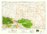
~ San Bernardino CA topo map, 1:250000 scale, 1 X 2 Degree, Historical, 1959
San Bernardino, California, USGS topographic map dated 1959.
Includes geographic coordinates (latitude and longitude). This topographic map is suitable for hiking, camping, and exploring, or framing it as a wall map.
Printed on-demand using high resolution imagery, on heavy weight and acid free paper, or alternatively on a variety of synthetic materials.
Topos available on paper, Waterproof, Poly, or Tyvek. Usually shipping rolled, unless combined with other folded maps in one order.
- Product Number: USGS-5506647
- Free digital map download (high-resolution, GeoPDF): San Bernardino, California (file size: 17 MB)
- Map Size: please refer to the dimensions of the GeoPDF map above
- Weight (paper map): ca. 55 grams
- Map Type: POD USGS Topographic Map
- Map Series: HTMC
- Map Verison: Historical
- Cell ID: 69012
- Scan ID: 299873
- Woodland Tint: Yes
- Datum: Unstated
- Map Projection: Transverse Mercator
- Map published by United States Army Corps of Engineers
- Map published by United States Army
- Map Language: English
- Scanner Resolution: 600 dpi
- Map Cell Name: San Bernardino
- Grid size: 1 X 2 Degree
- Date on map: 1959
- Map Scale: 1:250000
- Geographical region: California, United States
Neighboring Maps:
All neighboring USGS topo maps are available for sale online at a variety of scales.
Spatial coverage:
Topo map San Bernardino, California, covers the geographical area associated the following places:
- Puente Junction - Piñon Hills - Walnut Ridge - Smiley Heights - Amber Hills - Golden Mesa - Kramer - Harvard - Bethune - Desert Relief (historical) - Grandview - Bassett - Citrus - Crestline - Cushenbury - Serrano Village - Cloverleaf Canyon - Molino - Silver Lakes - Cajon Junction - Kincaid - Deer Haven - North Loma Linda - Hector - Adelanto - Patton - Etiwa (historical) - Lake Arrowhead - Devore - Broadwell - Barstow - Wild Crossing - Juniper Hills - Grapeland (historical) - Rana - Henshaw - Del Rosa - Arrowhead Highlands - Llano - Ludlow - Charter Oak Mobile Estates - Muscoy - Baldwin Park - Cajon - Landers - El Mirage - Big Bear Lake - Hesperia - Chino - Phelan - Old Point Comfort - Muroc (historical) - Highgrove - Nealeys Corner - Walnut Hills Mobile Home Park - Wrightwood - Silt - Yermo - Baldy Mesa - Lytle Creek - Glendora - Southridge Village - Nebo - Fluhr (historical) - Lugonia Homes - Marigold - Wilsona (historical) - Fawnskin - Mount Baldy - The Mesa - Cottage Gardens - Paradise Springs - Ontario - Bryman - Arrowhead Springs - Sunfair - Hillgrove - Sugarloaf - Warner - Mountain View - University Village - Mace (historical) - Woodlands - Crestmore - Rancho Cucamonga - Agua Fria - Glen Avon - Solon (historical) - South Adelanto - Rich - Cotners Corner - The Pines (historical) - Arrowhead Equestrian Estates - La Verne - Valencia - Arrowhead Farms - Three Points - Joshua Tree - Kenton Mill - Rowland
- Map Area ID: AREA3534-118-116
- Northwest corner Lat/Long code: USGSNW35-118
- Northeast corner Lat/Long code: USGSNE35-116
- Southwest corner Lat/Long code: USGSSW34-118
- Southeast corner Lat/Long code: USGSSE34-116
- Northern map edge Latitude: 35
- Southern map edge Latitude: 34
- Western map edge Longitude: -118
- Eastern map edge Longitude: -116


