
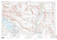
~ Salton Sea CA topo map, 1:250000 scale, 1 X 2 Degree, Historical, 1959, updated 1972
Salton Sea, California, USGS topographic map dated 1959.
Includes geographic coordinates (latitude and longitude). This topographic map is suitable for hiking, camping, and exploring, or framing it as a wall map.
Printed on-demand using high resolution imagery, on heavy weight and acid free paper, or alternatively on a variety of synthetic materials.
Topos available on paper, Waterproof, Poly, or Tyvek. Usually shipping rolled, unless combined with other folded maps in one order.
- Product Number: USGS-5506637
- Free digital map download (high-resolution, GeoPDF): Salton Sea, California (file size: 18 MB)
- Map Size: please refer to the dimensions of the GeoPDF map above
- Weight (paper map): ca. 55 grams
- Map Type: POD USGS Topographic Map
- Map Series: HTMC
- Map Verison: Historical
- Cell ID: 69008
- Scan ID: 299868
- Imprint Year: 1972
- Woodland Tint: Yes
- Visual Version Number: 1
- Aerial Photo Year: 1954
- Edit Year: 1969
- Field Check Year: 1959
- Datum: Unstated
- Map Projection: Transverse Mercator
- Map published by: Military, Other
- Map Language: English
- Scanner Resolution: 600 dpi
- Map Cell Name: Salton Sea
- Grid size: 1 X 2 Degree
- Date on map: 1959
- Map Scale: 1:250000
- Geographical region: California, United States
Neighboring Maps:
All neighboring USGS topo maps are available for sale online at a variety of scales.
Spatial coverage:
Topo map Salton Sea, California, covers the geographical area associated the following places:
- Bernice (historical) - Mesaville - Verdant - Munyon - Desert Camp - Estelle - Inca - Olive City (historical) - Ripley - Mountain Quail Mobile Home Park - Mesquite - Butlers (historical) - River Lagoon Resort Mobile Home Park - Elmore Desert Ranch - Picacho - Kane Spring - Mortmar - Crawfords Trailer Park - Fondo - Salton City - Ferrum - Blythe - Tortuga - Truckhaven - La Paz (historical) - Iris - Palo Verde - Desert Beach - Ehrenberg - Paymaster Landing - Amos - Niland - Lake Tamarisk - Blythe Marina Mobile Estates - Durmid - Eagle Mountain - Calipatria - Nommel Place - Morgantown - Cibola - Mesa Verde - Hovley - Poston - Wister - Westmorland - La Paz Valley - Midland - Bombay Beach - Mayflower (historical) - Plomosa - Bertram - Hayfield - Rannells (historical) - Tosco (historical) - Salton - Nortons Landing - Acolita - Cox - Wiest - Chiriaco Summit - Desert Center - Squeaky Springs (historical) - Quartzsite - Rockwood - East Blythe - Miller Farms - Cactus City - Mundo - Frink - Rancho Dos Palmas - Pope - Styx - Inperial Gables - Shamrock (historical) - Bouse
- Map Area ID: AREA3433-116-114
- Northwest corner Lat/Long code: USGSNW34-116
- Northeast corner Lat/Long code: USGSNE34-114
- Southwest corner Lat/Long code: USGSSW33-116
- Southeast corner Lat/Long code: USGSSE33-114
- Northern map edge Latitude: 34
- Southern map edge Latitude: 33
- Western map edge Longitude: -116
- Eastern map edge Longitude: -114


