
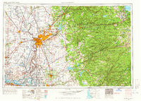
~ Sacramento CA topo map, 1:250000 scale, 1 X 2 Degree, Historical, 1957, updated 1966
Sacramento, California, USGS topographic map dated 1957.
Includes geographic coordinates (latitude and longitude). This topographic map is suitable for hiking, camping, and exploring, or framing it as a wall map.
Printed on-demand using high resolution imagery, on heavy weight and acid free paper, or alternatively on a variety of synthetic materials.
Topos available on paper, Waterproof, Poly, or Tyvek. Usually shipping rolled, unless combined with other folded maps in one order.
- Product Number: USGS-5506617
- Free digital map download (high-resolution, GeoPDF): Sacramento, California (file size: 21 MB)
- Map Size: please refer to the dimensions of the GeoPDF map above
- Weight (paper map): ca. 55 grams
- Map Type: POD USGS Topographic Map
- Map Series: HTMC
- Map Verison: Historical
- Cell ID: 68999
- Scan ID: 299857
- Imprint Year: 1966
- Woodland Tint: Yes
- Edit Year: 1964
- Field Check Year: 1957
- Datum: Unstated
- Map Projection: Transverse Mercator
- Map published by United States Army Corps of Engineers
- Map published by United States Army
- Map Language: English
- Scanner Resolution: 600 dpi
- Map Cell Name: Sacramento
- Grid size: 1 X 2 Degree
- Date on map: 1957
- Map Scale: 1:250000
- Geographical region: California, United States
Neighboring Maps:
All neighboring USGS topo maps are available for sale online at a variety of scales.
Spatial coverage:
Topo map Sacramento, California, covers the geographical area associated the following places:
- Milligan District (historical) - Saxon - Hicksville - Dunnigan - Martell - Crescent Ridge Village - Clay - Pokerville (historical) - Fornis - Rancho Cordova - Blue Lake Springs - Prairie City - Salmon Falls (historical) - Waterloo - Placerville - Folsom - Scottsville - Royal Oak Manufactured Home Community - Allendale - Trails End Mobile Home Park - Golden Chain Mobile Home Park - Routier (historical) - Paloma - Pope - Oak Creek Hills - Flonellis - Norval (historical) - Ranch House Estates - Lotus - Melones - Casa Mobile Home Park - Georgetown - Antioch - Camanche (historical) - Snowshoe Springs - Collinsville - East Sacramento - Lower Forni - Camp Connell - Belleview Acres - Cuesta Oaks - Pine Grove - Raffetto - Toyon - Thornton - Columbia - Norton - Fiddletown - Gold Trail Park - Van Vleck - Dagon - Del Paso - Golden Torch Trailer Park - Walerga - Twin Cities - Urgon - Sucro - Merritt - Leeman (historical) - Creed - McCulloh - Equestrian Village - Kirkville - Clarsona - Millertown (historical) - Douds Landing - Leonardi - Avery - Kettleman - Sandy Gulch - Morrison - Plumtree (historical) - Gardenland - Jenny Lind - Drytown - Karnak - Ronda (historical) - Nebelhorn - North Sacramento - Roseville - Pleasant Valley - Fruitridge Manor - Mother Lode Acres - Elvas - Greenwood - Hickok Ranch - Bullard - Arroyo Vista - Highland Park - Soudan - Denverton - Polk - Bowman - Lakewood Highlands - Knights Landing - Nashville - Travis Field - Cedar Ridge - Waterford Village - Upper Forni
- Map Area ID: AREA3938-122-120
- Northwest corner Lat/Long code: USGSNW39-122
- Northeast corner Lat/Long code: USGSNE39-120
- Southwest corner Lat/Long code: USGSSW38-122
- Southeast corner Lat/Long code: USGSSE38-120
- Northern map edge Latitude: 39
- Southern map edge Latitude: 38
- Western map edge Longitude: -122
- Eastern map edge Longitude: -120


