
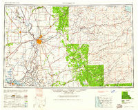
~ Sacramento CA topo map, 1:250000 scale, 1 X 2 Degree, Historical, 1947, updated 1961
Sacramento, California, USGS topographic map dated 1947.
Includes geographic coordinates (latitude and longitude). This topographic map is suitable for hiking, camping, and exploring, or framing it as a wall map.
Printed on-demand using high resolution imagery, on heavy weight and acid free paper, or alternatively on a variety of synthetic materials.
Topos available on paper, Waterproof, Poly, or Tyvek. Usually shipping rolled, unless combined with other folded maps in one order.
- Product Number: USGS-5506615
- Free digital map download (high-resolution, GeoPDF): Sacramento, California (file size: 15 MB)
- Map Size: please refer to the dimensions of the GeoPDF map above
- Weight (paper map): ca. 55 grams
- Map Type: POD USGS Topographic Map
- Map Series: HTMC
- Map Verison: Historical
- Cell ID: 68999
- Scan ID: 299856
- Imprint Year: 1961
- Woodland Tint: Yes
- Aerial Photo Year: 1945
- Datum: Unstated
- Map Projection: Transverse Mercator
- Map published by United States Army Corps of Engineers
- Map published by United States Army
- Map Language: English
- Scanner Resolution: 600 dpi
- Map Cell Name: Sacramento
- Grid size: 1 X 2 Degree
- Date on map: 1947
- Map Scale: 1:250000
- Geographical region: California, United States
Neighboring Maps:
All neighboring USGS topo maps are available for sale online at a variety of scales.
Spatial coverage:
Topo map Sacramento, California, covers the geographical area associated the following places:
- Lake Camanche Ranches - Antioch - McKay - Isleton - Buckeye Flat (historical) - Kilaga Springs - New Hope Landing - Twin Cities - Clayton - Voss - Ulatis Park - Pleasant Valley - Mariemont - Clinton - Sutter Creek - Vineyard - Stonegate Village - Sugarpine - Everglade - North Auburn - Quail Oaks - Green Springs Valley - Tahoe Keys - Ronda (historical) - Meadow Brook - Camanche Village - Sunset Mobile Home Park - Columbia Village - Jupiter - Conley (historical) - Springfield - East Side - Roseville - Vacaville - Outingdale - Gold Hill - Peltier - Walnut Grove - Live Oak - Cold Springs - Cannon - Chinatown (historical) - Ridgeview Village - McConnel Place - Deer Park - Polk - Lane - Violet (historical) - Shingle Springs - Bellota - Franciscan Village - Brela - Clipper Gap - Browns Corner - Plymouth - Sutter Hill - Valdez - Scenic Valley Ranchos - Winters Mobile Home Park - Swingle - Somerset - Green Springs Ranch - Bay Point - Dougherty - Armstrong - Oak Creek Hills - Spring Valley - Mather Field - Pinebrook - Sheridan - Lake Hills Estates - Oak Grove - Toyanza Subdivision - Buena Vista - Lake Valley - Belleview - Madison - Mountain Retreat - Oo-moo-chah (historical) - Laguna West - McAvoy - Algodon (historical) - Sierra Springs - Citrona - Comstock Ranch - Carson Hill - Big Trees - Pino Grande - Fornis - Trowbridge - Scenic Heights - Cambridge Oaks - Big Meadow - Bryants - Canyon View - Oak Park Estates - Toland Landing - Binghamton - Sucro - Camden
- Map Area ID: AREA3938-122-120
- Northwest corner Lat/Long code: USGSNW39-122
- Northeast corner Lat/Long code: USGSNE39-120
- Southwest corner Lat/Long code: USGSSW38-122
- Southeast corner Lat/Long code: USGSSE38-120
- Northern map edge Latitude: 39
- Southern map edge Latitude: 38
- Western map edge Longitude: -122
- Eastern map edge Longitude: -120


