
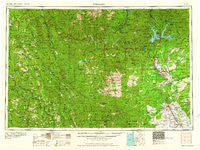
~ Redding CA topo map, 1:250000 scale, 1 X 2 Degree, Historical, 1958, updated 1960
Redding, California, USGS topographic map dated 1958.
Includes geographic coordinates (latitude and longitude). This topographic map is suitable for hiking, camping, and exploring, or framing it as a wall map.
Printed on-demand using high resolution imagery, on heavy weight and acid free paper, or alternatively on a variety of synthetic materials.
Topos available on paper, Waterproof, Poly, or Tyvek. Usually shipping rolled, unless combined with other folded maps in one order.
- Product Number: USGS-5506605
- Free digital map download (high-resolution, GeoPDF): Redding, California (file size: 24 MB)
- Map Size: please refer to the dimensions of the GeoPDF map above
- Weight (paper map): ca. 55 grams
- Map Type: POD USGS Topographic Map
- Map Series: HTMC
- Map Verison: Historical
- Cell ID: 75008
- Scan ID: 299850
- Imprint Year: 1960
- Woodland Tint: Yes
- Field Check Year: 1958
- Datum: Unstated
- Map Projection: Transverse Mercator
- Map published by United States Army Corps of Engineers
- Map published by United States Army
- Map Language: English
- Scanner Resolution: 600 dpi
- Map Cell Name: Redding
- Grid size: 1 X 2 Degree
- Date on map: 1958
- Map Scale: 1:250000
- Geographical region: California, United States
Neighboring Maps:
All neighboring USGS topo maps are available for sale online at a variety of scales.
Spatial coverage:
Topo map Redding, California, covers the geographical area associated the following places:
- Elmore (historical) - Platina - Del Loma - Portal Inn - Mad River - Holmes - Willow Creek - Lazy Landing Mobile Home Park - Churntown (historical) - Norgaar (historical) - Big Bar - Red Bank - Willie Hoaglin Place - Kelly (historical) - Northgate Trailer Park - Westend Galatin Place (historical) - Murphy Place - Bucktail - Bayles Place - Fairview - Cottonwood - Maple Grove - Wildwood - Riverland Mobile Home Park - Swain Place - Rancho Tehama Reserve - Holiday Harbor Resort - Minersville (historical) - French Gulch - Quartz Point Mobile Home Park - Pettyjohn Place - Shannon Place - Redding - Lakehead - Banfield Place - Shady Oaks Mobile Park - Douglas City - El Camino - Keno (historical) - Sids Place - Redding Oaks Mobile Home Park - Skinner Mill Place - Mountain Shadows Mobile Home Estates - Wigdon Place - Safari Mobile Home Park - Peanut - Blunt - Riverview - Anderson - Minnesota - Las Flores - Shasta Lake - Sugarloaf - Pete Hoff Place - Shasta Lake Mobile Home Park - Dyerville (historical) - Deluxe Mobile Park - Pepperwood - Ellis (historical) - Thorn Junction - Pawnee - Dedrick - Saunders Place - Hoboken - Junction City - Fernwood - Bob Hoaglin Place - Cottonwood Estates - River Park Mobile Estates - Shady Hill Trailer Park - Ydaloom (historical) - Irish Place (historical) - Smith (historical) - Hooker - Cloverdale - Red Bluff - Shasta - Churn Creek Mobile Home Park - McCann - Summit City (historical) - Copple Place - Whiskeytown - Calkins (historical) - Osborne - Cain Rock - Alderpoint - Lowrey - Harris - Gilliam Place - Middletown (historical) - Balls Ferry Fishing Resort - Quinby - Fitzpatrick (historical) - Redding Lakeside Mobile Estates - Hercraff Place - Denny - Brock Creek (historical) - Redcrest - Leonard Place (historical) - Kett
- Map Area ID: AREA4140-124-122
- Northwest corner Lat/Long code: USGSNW41-124
- Northeast corner Lat/Long code: USGSNE41-122
- Southwest corner Lat/Long code: USGSSW40-124
- Southeast corner Lat/Long code: USGSSE40-122
- Northern map edge Latitude: 41
- Southern map edge Latitude: 40
- Western map edge Longitude: -124
- Eastern map edge Longitude: -122


