
~ Needles CA topo map, 1:250000 scale, 1 X 2 Degree, Historical, 1954, updated 1954
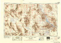
Needles, California, USGS topographic map dated 1954.
Includes geographic coordinates (latitude and longitude). This topographic map is suitable for hiking, camping, and exploring, or framing it as a wall map.
Printed on-demand using high resolution imagery, on heavy weight and acid free paper, or alternatively on a variety of synthetic materials.
Topos available on paper, Waterproof, Poly, or Tyvek. Usually shipping rolled, unless combined with other folded maps in one order.
- Product Number: USGS-5506593
- Free digital map download (high-resolution, GeoPDF): Needles, California (file size: 20 MB)
- Map Size: please refer to the dimensions of the GeoPDF map above
- Weight (paper map): ca. 55 grams
- Map Type: POD USGS Topographic Map
- Map Series: HTMC
- Map Verison: Historical
- Cell ID: 74967
- Scan ID: 299838
- Imprint Year: 1954
- Datum: Unstated
- Map Projection: Transverse Mercator
- Shaded Relief map: Yes
- Map published by United States Army Corps of Engineers
- Map published by United States Army
- Map Language: English
- Scanner Resolution: 600 dpi
- Map Cell Name: Needles
- Grid size: 1 X 2 Degree
- Date on map: 1954
- Map Scale: 1:250000
- Geographical region: California, United States
Neighboring Maps:
All neighboring USGS topo maps are available for sale online at a variety of scales.
Spatial coverage:
Topo map Needles, California, covers the geographical area associated the following places:
- Athos - Big River - Catfish Paradise - Goffs - Franconia - Valley Manor Mobile Home Park - Saltus - Milligan - Needles - Bluewater - Mojave Ranch Estates - Danby - Archer - Vidal - Parker Dam - Essex - Haviland - Cienega Springs - Lazy D Mobile Home Park - Amboy - Parker Trailer Park - Bagdad - Calzona - Siberia - Willow Valley - Ibis - Sablon - Chambless - Kerens - Freda - Jops Landing - Havasu Palms - Topock - Parker - Java - Parker Strip - Lakeview Mobile Home Park - Fenner - Lake Havasu City - Sunset Park Mobile Home Park - Parker Junction - Desert Hills Estates Mobile Home Park - Powell - Mesquite Creek - Arizona Village - Desert Hills - Yucca - Larneds Landing - Bannock - Havasu Lake - Fivemile Landing - Arrowhead Junction - Flynn - Chubbuck - Fishel - Glasgow - Rice - Bluewater - Black Meadow Landing - Earp - Tin Shack (historical) - Cross Roads - Klinefelter - Bush - Vidal Junction - Mohave Valley - Old Dale - Bransons Mobile Home Park - Homer - Cadiz
- Map Area ID: AREA3534-116-114
- Northwest corner Lat/Long code: USGSNW35-116
- Northeast corner Lat/Long code: USGSNE35-114
- Southwest corner Lat/Long code: USGSSW34-116
- Southeast corner Lat/Long code: USGSSE34-114
- Northern map edge Latitude: 35
- Southern map edge Latitude: 34
- Western map edge Longitude: -116
- Eastern map edge Longitude: -114


